Mount St. Helens
USA /
Washington /
Morton /
World
/ USA
/ Washington
/ Morton
World / United States / Washington
volcano, stratovolcano, draw only border
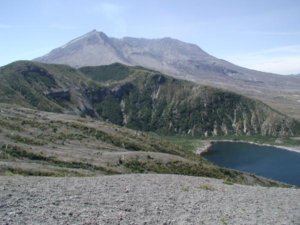
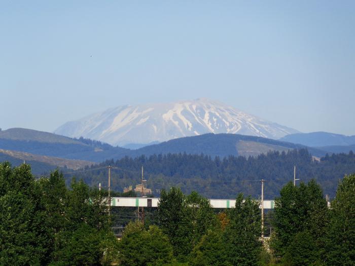
Mount St. Helens is an active stratovolcano in Skamania County, Washington, in the Pacific Northwest region of the United States. It is located 96 miles (154 km) south of the city of Seattle and 53 miles (85 km) northeast of Portland, Oregon. The mountain is part of the Cascade Volcanoes and the Cascade Range which takes its English name from the British diplomat Lord St Helens, who was a friend of George Vancouver, an explorer who made a survey of the area in the late 18th century. Mount St. Helens is a part of the Pacific Ring of Fire that includes over 160 active volcanoes. This volcano is well known for its ash explosions and pyroclastic flows.
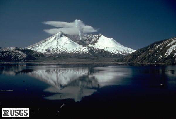
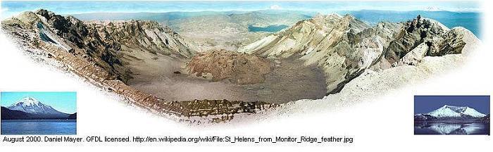
Mount St. Helens is most famous for its catastrophic eruption on May 18, 1980. The 1980 eruption of Mount St. Helens was the deadliest and most economically destructive volcanic event in the history of the United States. (In 1912, Mount Katmai, Alaska, was the site of the largest volcanic eruption in U.S. history.) Fifty-seven people were killed; and 250 homes, 47 bridges, 15 miles (24 km) of railways and 185 miles (300 km) of highway were destroyed. The eruption caused a massive debris avalanche, reducing the elevation of the mountain's summit from 9,677 feet (2,950 m) to 8,364 feet (2,550 m), and replacing it with a mile-wide (1.5 km-wide) horseshoe-shaped crater. The debris avalanche was up to 0.7 cubic miles (2.3 km³) in volume, making it the largest in recorded history. However, the scale of the blast is considered minor when compared with past debris avalanches elsewhere on Earth.
As with most other volcanoes in the Cascade Range, Mount St. Helens is a large eruptive cone consisting of lava rock interlayered with ash, pumice, and other deposits. The mountain includes layers of basalt and andesite through which several domes of dacite lava have erupted. The largest of the dacite domes formed the previous summit; and off of its northern flank sat the smaller Goat Rocks dome. Both were destroyed in the 1980 eruption.
peakbagger.com/peak.aspx?pid=2353
www.summitpost.org/mount-saint-helens/150360
www.wilderlist.app/mountain/5f04d20d676f544db0f0c635
Wikipedia article: http://en.wikipedia.org/wiki/Mount_St._Helens
Nearby cities:
Coordinates: 46°11'55"N 122°11'17"W
- Shiveluch Volcano, 3283 m 5151 km
- Klyuchevskaya Sopka 4750 m 5209 km
- Ushkovsky, 3943 m 5230 km
- Beerenberg 5968 km
- Volcano Askja 1,516 metres (4,974 ft) 6086 km
- Sahand Mountain Range 10601 km
- Nabro Volcano 13186 km
- Mallahle 13199 km
- Asavyo (Bara Ale) 13220 km
- Mount Kenya 14508 km
- Crater Ridge 0.3 km
- Crater Glacier (Tulutson Glacier) 0.3 km
- Mount St. Helens National Volcanic Monument 6.8 km
- Spirit Lake 8.9 km
- Coldwater Lake 12 km
- Swift Reservoir 17 km
- Gifford Pinchot National Forest 21 km
- Kosmos (Submerged City) 33 km
- Riffe Lake 34 km
- Indian Heaven Wilderness 39 km
Comments