Chikurachki
Russia /
Sahalin /
Severo-Kurilsk /
World
/ Russia
/ Sahalin
/ Severo-Kurilsk
, 83 km from center (Северо-Курильск)
World / Russia / Kamchatka
stratovolcano
Add category

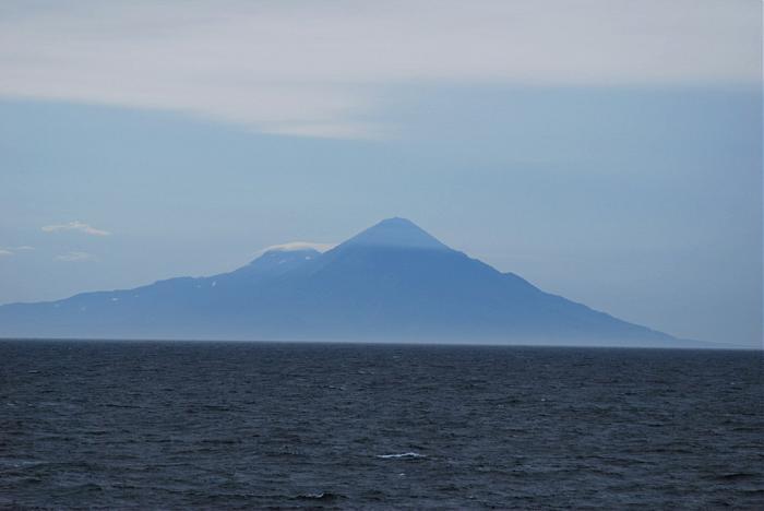
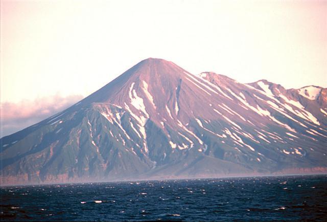
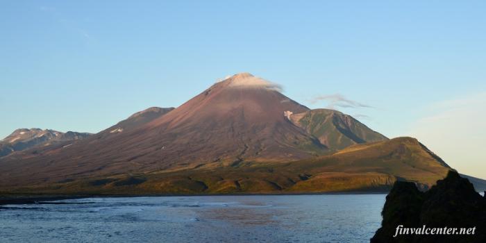
Chikurachki is the highest volcano on Paramushir Island in the northern Kuril islands, is actually a relatively small cone constructed on a high Pleistocene volcanic edifice. Oxidized andesitic scoria deposits covering the upper part of the young cone give it a distinctive red color. Lava flows from 1,816-metre (5,958 ft) high Chikurachki reached the sea and form capes on the NW coast; several young lava flows also emerge from beneath the scoria blanket on the eastern flank.
Wikipedia article: https://en.wikipedia.org/wiki/Chikurachki
Nearby cities:
Coordinates: 50°19'16"N 155°27'41"E
- Ushkovsky, 3943 m 731 km
- Klyuchevskaya Sopka 4750 m 737 km
- Shiveluch Volcano, 3283 m 809 km
- Beerenberg 6454 km
- Volcano Askja 1,516 metres (4,974 ft) 7166 km
- Sahand Mountain Range 8044 km
- Nabro Volcano 10481 km
- Mallahle 10497 km
- Asavyo (Bara Ale) 10517 km
- Mount Kenya 11970 km
- Krasheninnikova Bay 8.6 km
- Karpinsky Ridge 12 km
- Fussa Peninsula 15 km
- Fuss Volcano (1772 meters) 16 km
- Island Paramushir 17 km
- Luzhin Strait (Third Kuril Strait) 27 km
- Raduga Bay 29 km
- Vernadskii Ridge 42 km
- Puyshariya Bay 46 km
- Fourth Kuril Strait 60 km