Mount Rainier
USA /
Washington /
Ashford /
World
/ USA
/ Washington
/ Ashford
World / United States / Washington
volcano, stratovolcano


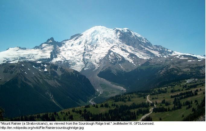

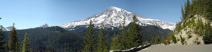
Mount Rainier is a stratovolcano and national park southeast of Seattle, Washington in Pierce County. The most recent recorded eruption was between 1820 and 1854, but many eyewitnesses reported eruptive activity in the late 1800s. It is an active stratovolcano just southeast of the Sea-Tac area. At 14,410 ft (4392 m), it is the highest volcano in the Cascades. It is also one of the most dangerous, as it has produced enormous mudflows which went as far as where metropolitan Seattle-Tacoma sits today in the recent geologic past.
www.summitpost.org/mount-rainier/150291
listsofjohn.com/peak/16668
www.peakbagger.com/peak.aspx?pid=2296
www.wilderlist.app/mountain/5f04d20d676f544db0f0ca5b
www.summitpost.org/mount-rainier/150291
listsofjohn.com/peak/16668
www.peakbagger.com/peak.aspx?pid=2296
www.wilderlist.app/mountain/5f04d20d676f544db0f0ca5b
Wikipedia article: http://en.wikipedia.org/wiki/Mount_Rainier
Nearby cities:
Coordinates: 46°51'15"N 121°44'55"W
- Mount St. Helens National Volcanic Monument 65 km
- Newberry National Volcanic Monument 320 km
- Voltage Flow 446 km
- Saddle Butte Lava Field 509 km
- Hell's Half Acre 812 km
- Huckleberry Ridge Tuff Caldera 825 km
- Henry's Fork Caldera 837 km
- Yellowstone Caldera 860 km
- Volcanic plateau 1469 km
- Atlin Volcanic Field 1638 km
- Emmons Glacier 3.1 km
- Winthrop Glacier 3.8 km
- Tahoma Glacier 4.9 km
- Mount Rainier National Park 5.2 km
- Tatoosh Range 16 km
- Mount Tahoma Trails (north district) 22 km
- Mount Tahoma Trails (south district) 27 km
- Alder Lake 40 km
- Graham, Washington 45 km
- Gifford Pinchot National Forest 67 km
Comments