Fort Pargad (Taluka.Chandgad Dist.Kolhapur)
India /
Goa /
Bicholim /
World
/ India
/ Goa
/ Bicholim
World / India / Maharashtra / Kolhapur


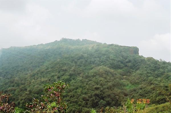

Dr dilip ganpatrao phal(photos and information by) :Fort Pargad (Taluka.Chandgad Dist.Kolhapur)the fort of the greatest king chattrapati shivaji maharaj can be visited either road head kolhapur- sankeshwer-chandgad- gadhingalaj- isapur-pargad(4km) or road head sawantwadi- banda- talkat- bhekurali phata- then trek to climb bhekulai village (1hour) - either get down and stiff climb to direct fort pargad (2hours) or trek steady climb to isapur village (1.5hour) and reach pargad(4km)via road or from road head amboli - chokul(11km)- from chokul trek down to isapur village (3hours) and follow the above mentioned route to pargad fort.but their exist the still shortest trek route from dodamarg via maye village.
Nearby cities:
Coordinates: 15°48'59"N 74°2'45"E
- Mirwel Villege 1.3 km
- miravel 1.9 km
- morle-pargad projected ghad road 2.1 km
- DURG 2.8 km
- Sonawal Village 2.8 km
- Hill Area 3.7 km
- Suresh Rawool plot 4.4 km
- Suresh Rawool 4.6 km
- medhe village (dodamarg) 4.8 km
- waterfall 5.9 km
- Paar Gad 0.1 km
- Gyr Kumbha 2.3 km
- Gyr Kumbha 2.4 km
- Gyr kumbha 2.9 km
- Gyr kumbha 2.9 km
- KESHAV LADUJI GAWADE 4.3 km
- Karmapur Kaju plantation 4.9 km
- Kumbhavade 5.2 km
- Kegadwadi (Chaukul) 5.6 km
- Sawantwadi 20 km
Comments