Thórisjökull
| mountain, glacier
Iceland /
Sudurland /
Laugarvatn /
World
/ Iceland
/ Sudurland
/ Laugarvatn
World / Iceland / Vesturland
mountain, glacier
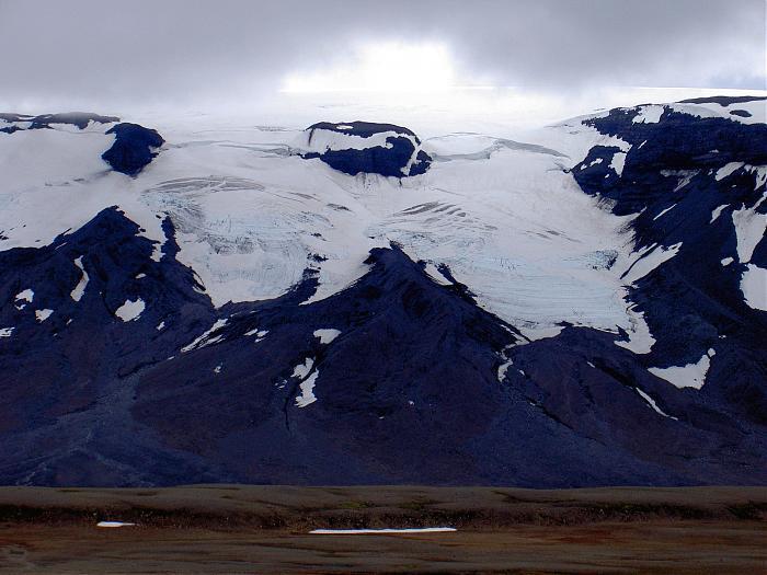

Thórisjökull (Þórisjökull) is a small glacier and volcano in western-central Iceland, to the southwest of Langjökull glacier. It has an elevation of 1350 metres. Kaldidalur (Cold Valley) lies in the foreground.
Wikipedia article: http://en.wikipedia.org/wiki/Þórisjökull
Nearby cities:
Coordinates: 64°32'41"N 20°41'59"W
- Langjökull 39 km
- Hofsjökull 87 km
- Eyjafjallajökull 108 km
- Laki 119 km
- Vestmannaeyjar 119 km
- Vatnajökull 125 km
- Grímsvötn 156 km
- Volcano Askja 1,516 metres (4,974 ft) 192 km
- Öræfajökull 192 km
- Drangajökull 204 km
- Geytlandsjökull 8.3 km
- Ok 11 km
- Góra 15 km
- Geitlandshraun 17 km
- Hagafell 18 km
- Eiriksjökull 29 km
- Langjökull 29 km
- Thingvellir National Park 35 km
- Hvítárvatn 42 km
- Þingvallavatn 45 km