HULA, B Side
USA /
Hawaii /
Makaha /
World
/ USA
/ Hawaii
/ Makaha
World / United States / Hawaii
point, military
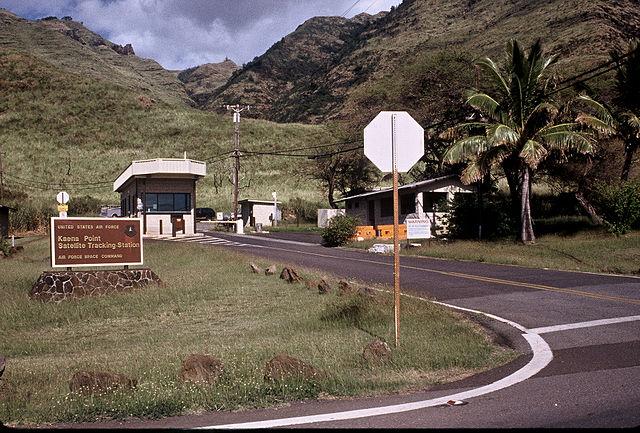
The antenna located in the radome here is used for telemetry tracking and command of low earth orbit satellites.
Wikipedia article: http://en.wikipedia.org/wiki/Kaena_Point_Satellite_Tracking_Station
Nearby cities:
Coordinates: 21°34'8"N 158°15'44"W
- Ka'ena Point State Park 1.5 km
- Point Lobos State Natural Reserve 3875 km
- Lawn Point Provincial Park 4152 km
- Black Point 4285 km
- Point Whitehorn 4364 km
- Cherry Point 4364 km
- Sandy Point 4554 km
- Promontory Point 4801 km
- Iowa Point 6646 km
- Boies Point 6648 km
- Kuaokalā Game Management Area 2.8 km
- Dillingham Airfield 6.8 km
- Makua Military Reservation 7.1 km
- Dillingham Ranch 7.9 km
- Makua Keaau Forest Reserve 10 km
- Mokulēʻia Forest Reserve 11 km
- Makaha Golf Club West 12 km
- Oʻahu 32 km
- Wai'anae Slump 42 km
- Kaʻieʻie Waho Channel 53 km