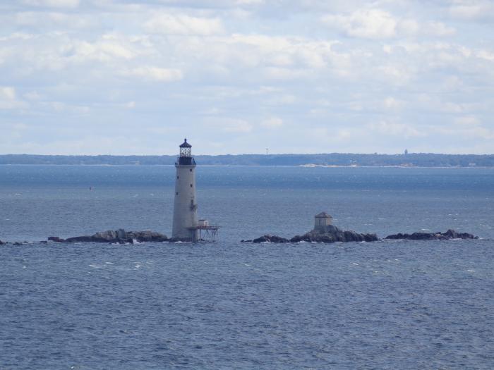
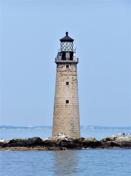
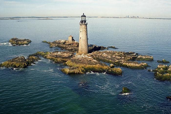
Graves Light
USA /
Massachusetts /
Hull /
World
/ USA
/ Massachusetts
/ Hull
World / United States / Massachusetts
lighthouse, foghorn


Graves Light - Lighthouse
Funds for the construction a lighthouse and fog signal on a ledge known as the Graves, at the enterence to Boston harbor was appropriated by Congress in 1902. initially bugeted at $75,000, and additional $113,000 was requested in 1904.
Funds for the construction a lighthouse and fog signal on a ledge known as the Graves, at the enterence to Boston harbor was appropriated by Congress in 1902. initially bugeted at $75,000, and additional $113,000 was requested in 1904.
Wikipedia article: http://en.wikipedia.org/wiki/Graves_Light
Nearby cities:
Coordinates: 42°21'54"N 70°52'9"W
- Beavertail State Park 110 km
- Mount Desert Rock Lighthouse 285 km
- Baker Island - Acadia National Park 301 km
- Île Ste-Thérèse Upper Range 423 km
- Contrecoeur-Verchères Range 435 km
- Port Saint-François Range 457 km
- Bécancour Range 464 km
- Gentilly Range 466 km
- Pointe des Grondines Range 480 km
- Rivière Valin Range 679 km
- Winthrop, Massachusetts 7 km
- Nahant, Massachusetts 8 km
- Long Island 9 km
- Peddocks Island 10 km
- Swampscott, Massachusetts 10 km
- Logan International Airport (BOS/KBOS) 11 km
- East Boston 12 km
- Cohasset, Massachusetts 13 km
- South Boston 14 km
- Squantum 14 km