Long Island (Boston, Massachusetts)
USA /
Massachusetts /
Boston /
Boston, Massachusetts
World
/ USA
/ Massachusetts
/ Boston
World / United States / Massachusetts
island
Add category
www.nps.gov/boha/historyculture/upload/facts_long.pdf
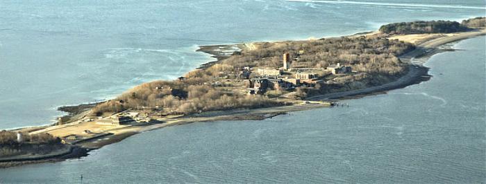
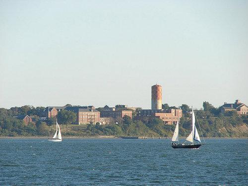
Boston Harbor Islands National Recreation Area
At one time home to an old fort, it was used to house the homeless and was serviced by two "secret" bus lines that transport them, the buses were the only vehicles allowed over the bridge. The homeless shelter was closed in 2015 and the bridge was demolished.
Wikipedia article: http://en.wikipedia.org/wiki/Long_Island_(Massachusetts)
Nearby cities:
Coordinates: 42°19'14"N 70°57'55"W
- Plum Island 57 km
- Prudence Island 80 km
- Isles of Shoals 81 km
- Naushon Island 90 km
- Conanicut Island - Jamestown 91 km
- Martha's Vineyard 94 km
- Chappaquiddick Island 107 km
- Block Island, Rhode Island 133 km
- Fishers Island, New York 145 km
- Gardiner's Island 165 km
- Squantum 4.7 km
- South Boston 6 km
- Logan International Airport (BOS/KBOS) 6 km
- Winthrop, Massachusetts 6.9 km
- East Boston 7 km
- Belle Isle Marsh 7.9 km
- Revere Beach 11 km
- Nahant, Massachusetts 12 km
- Cohasset, Massachusetts 15 km
- Swampscott, Massachusetts 17 km
Comments