Columbia River Bar
USA /
Washington /
Ilwaco /
World
/ USA
/ Washington
/ Ilwaco
World / United States / Oregon
river mouth
Add category
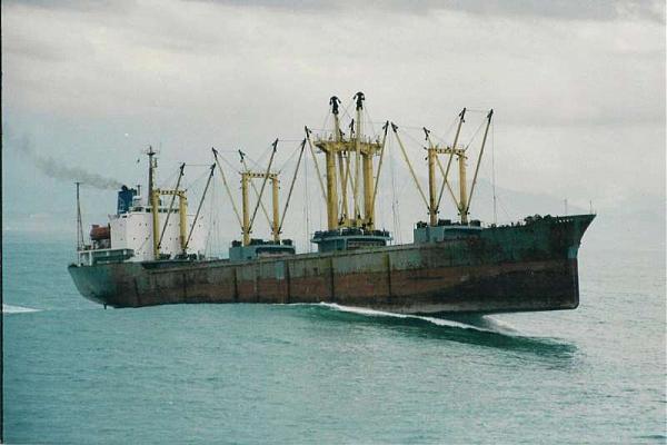
Hundreds of sunken ships, hundreds of lives taken. This is one of the most hazardous places for marine operations in the world.
Wikipedia article: http://en.wikipedia.org/wiki/Columbia_Bar
Nearby cities:
Coordinates: 46°14'54"N 124°2'51"W
- Columbia Delta 7.7 km
- Nehalem Bay 61 km
- Confluence of the John Day River and Columbia River 267 km
- Confluence 393 km
- Marguerite River meets Firebag River 1539 km
- Firebag River meets Athabasca River 1542 km
- Starting Point of River MacKenzie 1720 km
- The Mackenzie River and Liard River Confluence 1747 km
- Slave River Delta 1819 km
- Delta of the Red River of the North 2049 km
- Cape Disappointment State Park 4.2 km
- Fort Stevens State Park 7.3 km
- Desdemona Sands 13 km
- Camp Rilea Armed Forces Training Facility 15 km
- Columbia Delta 16 km
- Youngs Bay 16 km
- Naselle, Washington 23 km
- Willapa National Wildlife Refuge 23 km
- Long Island 24 km
- Ocean Park, Washington 27 km