Federal Office Building 3 - Demolished
USA /
Maryland /
Suitland-Silver Hill /
World
/ USA
/ Maryland
/ Suitland-Silver Hill
World / United States / Maryland
administrative building, historical layer / disappeared object
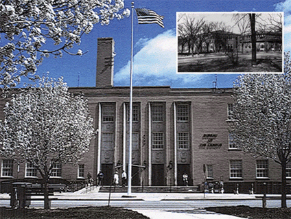
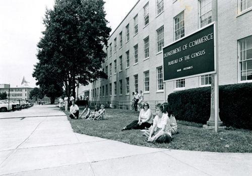
US Census Bureau, Building 3.
Census Bureau Headquarters 1942-2007 - Now demolished.
2nd photo is Federal Office Building #3, with Building #4 in the background (left), ca. 1980
Census Bureau Headquarters 1942-2007 - Now demolished.
2nd photo is Federal Office Building #3, with Building #4 in the background (left), ca. 1980
Nearby cities:
Coordinates: 38°50'53"N 76°55'43"W
- Suitland Federal Center 1.6 km
- Turner-Fairbank Highway Research Center 23 km
- Central Intelligence Agency 23 km
- Liberty Crossing Intelligence Campus 26 km
- Smokey Glen Farm 43 km
- National Conference Center 56 km
- Johns Hopkins University, Mount Washington campus 63 km
- Wye River Conference Center 70 km
- Wakefield Valley Golf Course 82 km
- Lancaster Host Golf Resort and Conference Center 145 km
- Former US Census Bureau Campus 0.1 km
- Suitland High School 1.3 km
- Washington National Cemetery 1.4 km
- Suitland-Silver Hill, Maryland 1.4 km
- Lincoln Memorial Cemetery 1.9 km
- Hillcrest Heights, Maryland 2.8 km
- Metrorail Branch Avenue Yard 2.9 km
- Marlow Heights, Maryland 2.9 km
- Camp Springs, Maryland 5.1 km
- Oxon Hill-Glassmanor, Maryland 6.2 km