St Saviour's Dock (London)
United Kingdom /
England /
London
World
/ United Kingdom
/ England
/ London
World / United Kingdom / England
water, dock (maritime)
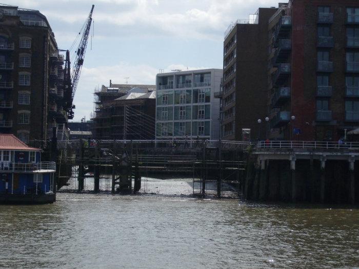
Originally the mouth of the River Neckinger, it was embanked as part of major infrastucture works by the monks of Bermondsey Abbey. Later, there was a gibbet on the waterfront where pirates were hanged using the "Devil's Neckinger" or Neckcloth. The area was heavily populated by the late 17th century and deteriorated into the "Venice of Drains"described by Charles Dickens. Part of his novel, Oliver Twist was set here. The later Victorians cleared the older slums and built warehouses and mills, some of which survive, converted into flats. There is a fantastic view along the dock from the footbridge at the north end.
Wikipedia article: http://en.wikipedia.org/wiki/St_Saviour's_Dock
Nearby cities:
Coordinates: 51°30'5"N -0°4'19"E
- Avonmouth Docks 183 km
- Royal Portbury Dock - Port of Bristol 184 km
- Cardiff Docks 214 km
- Immingham Docks 239 km
- Albert Dock 250 km
- King's Dock 267 km
- Queen's Dock 267 km
- Ramsden Dock 359 km
- Harland and Wolff Heavy Industries - Shipyard 523 km
- Grangemouth Port 559 km
- Bermondsey Spa 0.5 km
- Bermondsey 0.9 km
- Wapping 1 km
- St. George in the East 1.1 km
- Tabard Gardens Estate 1.2 km
- Newington 1.5 km
- Tower Hamlets Council 3 km
- Central London 3.5 km
- Southwark Council 4 km
- Lambeth Council 5.4 km