Gaya Head
Malaysia /
Sabah /
Kota Kinabalu /
World
/ Malaysia
/ Sabah
/ Kota Kinabalu
World / Malaysia / Sabah
headland (geography)
Add category

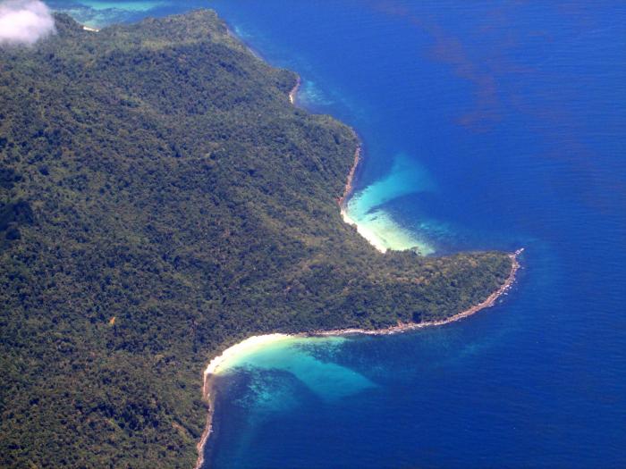
A headland facing the South China Sea as part of the Karambunai Peninsula. In Malay, it is called Tanjung Gaya. This place used to be a guide for ships and those at sea as it was noted in old maps of Jesselton. Other than viewing it from sea, the only possible place to view it from land would be at the western shores of Sepangar Island, on certain shores of Gaya Island, and also from the city centre and Sutera Harbour.
Nearby cities:
Coordinates: 6°6'30"N 116°5'11"E
- Tanjung Tavajun 10 km
- Tanjung Bulijong 12 km
- Bahia Honda Point, Palawan 428 km
- Tanjung Senyangang 752 km
- Cauitan Point 824 km
- Giligaon Point 824 km
- Cape Encanto 1231 km
- Tanjung Liliamaceceke 1427 km
- Tanjung Pinang 1449 km
- Tanjung Posi-posi 1455 km
- Penaga Hill 0.9 km
- Peduk Island 2.6 km
- Nexus Resort Karambunai Resort & Golf Club 2.6 km
- SK TLDM 2.8 km
- Medical Centre 2.8 km
- Udar Kechil Island 2.8 km
- Sepanggar Naval Base (Mawilla 2) 3.1 km
- Tanjung Melanim 3.2 km
- Udar Besar Island 3.3 km
- Sepangar Island 4.7 km