Onekotan Island
Russia /
Sahalin /
Severo-Kurilsk /
World
/ Russia
/ Sahalin
/ Severo-Kurilsk
, 196 km from center (Северо-Курильск)
World
uninhabited island
Add category

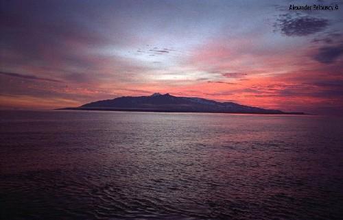


(Russian: Онекотан), also known as Onekotan To, is an island located near the northern end of the Kurils. Onekotan is a volcanic island, part of the "Ring of Fire" that encircles the Pacific Ocean. The area of the island is 315 km². It is 42,5 km in length and 11-16,7 km wide.
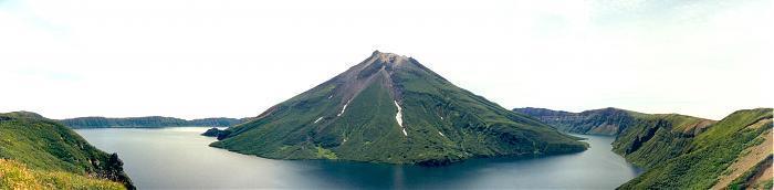
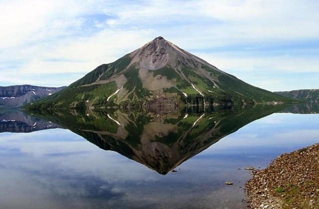
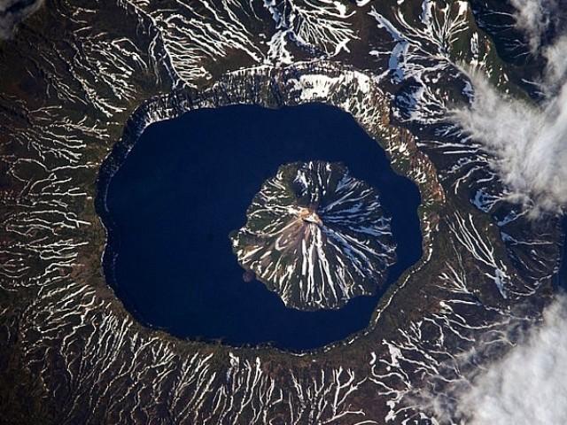
Onekotan Island is unique because it has a water-filled caldera at both the northern and the southern ends of the island. The more prominent caldera at the southern end of the island has "an island within the island" and is known as the Tao-Rusyr Caldera. The highest elevation on Onekotan Island is Krenitsyn which rises to 1325 meters above sea level on the island that lies within the caldera. This volcano was named after Captain Pyotr Krenitsyn of the Imperial Russian Navy. More recent secondary volcanic cones have formed in both calderas; the northern caldera has almost been filled by the subsidiary cone, Nemo Peak.
There are chars in Lake Chyornoye, one of the two lakes on Onekotan, located at the northern end of the island.
Onekotan Island is separated from the neighboring islands by the Fourth Kuril Strait, Yevreinov Strait, and Krenitsyn Strait.
Administratively this island belongs to the Sakhalin Oblast of the Russian Federation.
Wikipedia article: http://en.wikipedia.org/wiki/Onekotan
Nearby cities:
Coordinates: 49°26'47"N 154°45'51"E
- Kharimkotan Island 38 km
- Shiashkotan 83 km
- Atlasov Island Volcano 171 km
- Rasshua 226 km
- Ketoy Island 288 km
- Simushir Island 340 km
- Urup Island 537 km
- Zelyony Island 935 km
- Pagan Island 3575 km
- Henry Lawrence Island 6958 km
- Krenitsyn 11 km
- Tao-Rusyr Caldera 12 km
- Caldera and volcano 13 km
- Nemo Mountain 14 km
- Lake Chyornoye 15 km
- Mount Asyrmirtar 20 km
- Fourth Kuril Strait 49 km
- epicenter of m4.7 quake 101 km