Mankayan
| town, municipality, third-level administrative division
Philippines /
Cordillera /
Tabio /
World
/ Philippines
/ Cordillera
/ Tabio
World / Philippines / Benguet / Mankayan
town, municipality, third-level administrative division
Municipality of Mankayan, Province of Benguet
ZIP Code: 2608
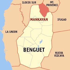
Mankayan is a municipality in the landlocked province of Benguet in the Philippines. It had a population of 35,586 people as registered in the 2010 Census. Situated at the northeastern tip of the province, it is known as a mining town.
Mankayan is politically subdivided into 12 barangays:
-Balili
-Bedbed
-Bulalacao
-Cabiten
-Colalo
-Guinaoang
-Paco
-Palasaan
-Poblacion
-Sapid
-Tabio
-Taneg
ZIP Code: 2608
Mankayan is a municipality in the landlocked province of Benguet in the Philippines. It had a population of 35,586 people as registered in the 2010 Census. Situated at the northeastern tip of the province, it is known as a mining town.
Mankayan is politically subdivided into 12 barangays:
-Balili
-Bedbed
-Bulalacao
-Cabiten
-Colalo
-Guinaoang
-Paco
-Palasaan
-Poblacion
-Sapid
-Tabio
-Taneg
Wikipedia article: http://en.wikipedia.org/wiki/Mankayan,_Benguet
Nearby cities:
Coordinates: 16°51'0"N 120°47'15"E
- Echague 86 km
- Tabuk 91 km
- Ilagan 118 km
- Tineg 126 km
- San Mariano 127 km
- Dinapigue 135 km
- Peñablanca 149 km
- Nueva Era 153 km
- Kabugao 153 km
- Calanasan 189 km
- Queensberry Mining 3.1 km
- Lepanto Mines 4.8 km
- Mt. Data Forest Reservation 7.5 km
- Mount Data Plateau 7.7 km
- Pasna-an,Balili,Mankayan kad an Black jack 8 km
- AM-AM 8.1 km
- Lenga 8.4 km
- Mount Mogao or also known as Mount Clitoris. 12 km
- Mountain Forest 19 km
- Ilocos Sur 52 km