Dhosi hill (The land of Bhargava's)
India /
Haryana /
Narnaul /
World
/ India
/ Haryana
/ Narnaul
World / India / Haryana / Mahendragarh
hill, volcano, religion, extinct volcano
Dhosi Hill is an extinct volcano, standing alone at the north-west end of the Aravalli mountain range, of which it is a part, with height varying from about 345 to 470 meters from the surrounding land and 740 meters from the sea level. It has temple, pond, fort and caves on the top and forest around it. The Aravalli range is a Precambrian Malani igneous suite of rocks that have been dated at 732 Ma BP (million years before present)
The hill has all the physical features of a perfect volcanic hill with distinct crater, lava still lying on it and giving a perfect conical view from top
Bhargavas, also called Dhusar Brahmins, had their origin from the area near Dhosi Hill on the banks of Vadhusar river. Dhosi Hill is located in the ancient Vedic state of Brahmavarta, presently on the borders of Indian states Rajasthan and Haryana, area called Shekhawati. Part of 'Brahmavarta' state lies in South Haryana. Dhosi Hill is located 5 KMs from Narnaul and 60 KMs from Rewari. Bhargava community owe their lineage to Bhrigu Rishi, and his son Chyavana Rishi,who is better known for his links with creation of Chyawanprash. by Abhishek Bhargava Indore(abhishekbhargava007@gmail.com)
Nearby cities:
Coordinates: 28°3'41"N 76°1'56"E
- Thana 0.5 km
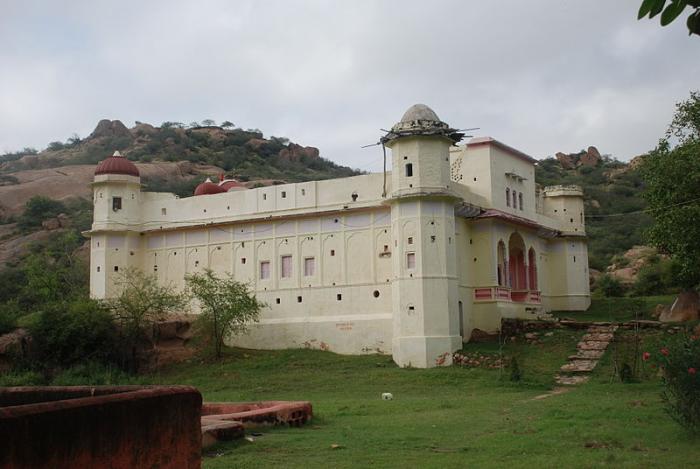
- Dhosi Hill Fort 0.5 km
- Swarag Aashram 6.6 km
- BABA BHIKHAM DAS TAMPLE DOSTPUR 23 km
- GARHI RUTHAL 25 km
- MLA Naresh Yadav ateli 29 km
- Balaji Mandir Sangtera 38 km
- Rao Ramsawrup Sarpanch Bharafia & Sish Ram Dudya ki Dhani 40 km
- Ashram 56 km
- Baba Santdas Temple 61 km
- Dhosi Hill Fort 0.1 km
- Stairs to Dhosi hill 0.7 km
- Abhishek Raj Mehta Farm House 2 km
- Mehta Farm 2.2 km
- mere khet mera gaon by:-anurag yadav 2.5 km
- oasis school narnaul 2.8 km
- Hills of Raghunathpura part-2 3.2 km
- PROPOSED MEDICAL COLLEGE AREA 3.8 km
- PROPOSED MEDICAL COLLEGE 4.1 km
- DHOSI MOUNTAIN 4.2 km
Comments