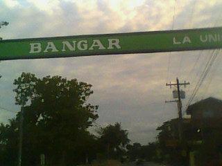
Bangar
Philippines /
Ilocos /
Luzong /
World
/ Philippines
/ Ilocos
/ Luzong
World / Philippines / La Union / Bangar
town, municipality, third-level administrative division


Municipality of Bangar, Province of La Union
ZIP code: 2519
Bangar is a coastal municipality in the province of La Union in the Philippines. As of the 2010 Census, it had a population of 34,522 people.
It is composed of 33 barangays with an area approximately 4,379 of land lies on the northern tip of La Union. It is bounded by the China Sea on the western side, Tagudin Ilocos Sur on the north, Sudipen on the east and Balaoan and Luna on the southwestern side.
*Etymology:
The town Bangar (pronounced: Bang-Gar) got its name from the bangar (pronounced: ba- ngar) tree which was growing abundantly in the place where the town now stands.
Bangar has 33 barangays. Four are coastal barangays, namely Paratong Norte, Paratong Norte 3, Paratong Norte 4, and Mindoro, which is an island barangay. Eleven barangays are along the Amburayan River namely, Bangaoilan East and West, Gen. Prim East and West, Maria Cristina East and West, Consuegra, Gen. Terrero, Alzate, Quintarong and Caggao. Barangay Rissing is the largest barangay in Bangar in terms of land area and population.
The different barangays of Bangar are grouped into 9 districts, as follows:
*ABCQM District:
-Alzate
-Barraca
-Caggao
-Quintarong
-Mindoro
*Ag-Na District:
-Agdeppa
-Nagsabaran
*CadaLuSan District:
-Cadapli
-Luzong Norte
-Luzong Sur
-San Cristobal
*Centro District:
-Central East No. 1
-Central East No. 2
-Central West No. 1
-Central West No. 2
-Central West No. 3
*GenPriBa District:
-General Prim East
-General Prim West
-Bangaoilan East
-Bangaoilan West
*Paratong District:
-Paratong Norte
-Paratong No. 3
-Paratong No. 4
*RUS District:
-Reyna Regente
-Ubbog
-San Blas
*SinapRis District:
-Sinapangan Norte
-Sinapangan Sur
-Rissing
*TerConMaCris District:
-General Terrero
-Consuegra
-Maria Cristina East
-Maria Cristina West
Bangar is composed of 16 public elementary schools and 1 private elementary school:
1. St. Christopher Academy- Elementary Department
2. Agna Elementary School
3. Bangaoilan Elementary School
4. Bangar Central School
5. Cadapli Elementary School
6. Caggao Elementary School
7. Gen. Prim Elementary School
8. Luzong Norte Elementary School
9. Luzong Sur Elementary School
10. Ma. Cristina Elementary School
11. Mindoro Elementary School
12. Paratong Elementary School
13. Pudoc Primary School
14. Rissing Elementary School
15. RUS Elementary School
16. Sinapangan Elementary School
17. Ter-con Elementary School
High schools:
Currently Bangar has four complete secondary schools; 1 Private Diocesan, which is also the oldest school in Bangar, 2 National High Schools and 1 Specialized Science High School.
Below is a list of high schools in Bangar:
1. Saint Christopher Academy (High School department)- founded in 1945, it is the oldest secondary school in the municipality.
2. Doña Francisca Lacsamana de Ortega Memorial National High School
3. Casacristo National High School
4. Regional Science High School for Region 1
Vocational schools:
TSI Technical Institute - is the first and only technical/vocational school in the municipality, located at Barangay Rissing.
Tertiary schools:
Currently Bangar has no tertiary schools. There were plans of putting up a college in the future.
Trivia:
* The Patron saint of Bangar is St. Christopher. Bangareños celebrate the feast of their patron saint every July 25.
* The Town Fiesta of Bangar is celebrated every December 26 & 27.
* Abel-Panday festival was first celebrated during 2005 town fiesta of Bangar. However the festival wasn't followed due to some circumstances.
* Bangar's main product is "abel" and "panday."
History:
The town of Bangar got its name from the bangar tree which, during the Spanish regime, was growing abundantly in the place where the town now stands. The bangar tree which is more known because of the foul odor that emanates from its fruit had other valuable usages, however. Planks made from the dried tree were prized boards for the interior of houses while its fruits when soaked in oil are used as deep red dye for the hand woven products. The “indios infieles” (Spanish term given to people who were not yet Christianized) used to spacious shade of the tree in performing their superstitious cult.
The old town of Bangar was made of three “pueblecitos” (small towns) namely: Villa-Cruz, San Rafael and San Anastacio. Near these “pueblecitos” were small communities of the “Igorotes Infieles” who paid tribute to the Governor. On the northern side of the town flowed the Amburayan river which later on became the setting of the Ilocano epic Biag ni Lam-ang penned by the Prince of Ilocano Poets, Pedro Bucaneg. This river was also another source of income for the inhabitants because in it were gold dusts and granules which were panned and collected. On the eastern side, the hills and mountains were forested with different kinds of timbers. It was there where the people got timber for their houses. On the western side of the town flowed the Busilac river which was a favorite fishing ground for the residents. Farther on the eastern side at a distance which was covered by ten hours of walking was the village Panguatan and still father away was Bacong. These two communities were inhabited by pagans.
The year 1700 marked the official foundation of Bangar under the patronage of Saint Christopher when it became a ministry. However, Christianity was brought as early as in the later part of 1500 when Bangar was still a visita of Tagudin. A book HIstoria Agustiniana, authored by Fr. Isacio R. Rodriguez stated that the massive church was started in 1696 and was finished in 1697 by Fr. Francisco Alvear, a learned Spanish Augustinian priest born in Liaño Santander, Spain. He died in Banger in 1698.
Through the “Superior Decreto” (executive decree) signed by Governor General Antonio Maria Blanco on March 2, 1850, the town of Bangar was made a part of La Union, the newly created province. Before 1850, Bangar, Purao (Balaoan) and Namacpacan (Luna) were parts of Ilocos Sur.
The beginning of World War II was felt in Bangar on December 8, 1941. Planes were constantly flying and on December 10, the townspeople fled to the barrios and nearby hills bringing along with them only important things. People stayed at evacuation places until it was safe for them to return to the town. Image
Underground movement was very strong in Bangar at that time, Many residents joined the guerillas which had put up camps in Barangay San Cristobal led by Colonel Volkman and Major Agtarap. Three years later, the Japanese raided their camp and burned houses at the town proper.
Everything was not fearful, though, during the Japanese occupation. There were also soldiers who were very kind, friendly and understanding. They took time to teach the youth ball games, athletics and good things about Japan.
ImageBangar is famous for its loom-weaving industry. The big bulk of orders for placemats, towels, draperies, curtains, blankets and even bathrobes from all over the country and even abroad speaks well of the quality of Bangar woven products. Agriculture, however, still remains the main source of income for the people of Bangar. Its principal crop is rice while tobacco comes next. Farmers also find planting corn, peanuts and vegetable crops quite lucrative source of additional income in between cropping.
Fishing also occupies a greater time of the people from the coastal barangays of Bangar. Ipon which comes out from the month of August to April is caught abundantly along these coastal areas. Bangus fry is caught from March to the earlier part of July. Tuna fish locally known as oriles and codfish abound in the coastal waters of this town. The Amburayan river also teems with fresh water varieties of fish (purong, tibek and birot) and shell (jusiling, suso and gusipeng).
Wikipedia article: http://en.wikipedia.org/wiki/Bangar,_La_Union
Nearby cities:
Coordinates: 16°52'43"N 120°26'0"E
- Echague 124 km
- Tineg 126 km
- Conner 136 km
- Nueva Era 147 km
- Kabugao 158 km
- San Mariano 164 km
- Dinapigue 172 km
- Peñablanca 176 km
- Calanasan 192 km
- Lal-lo 193 km
- Sitio Camanggaan 1 & 2 1.4 km
- Sitio Bubos 1.6 km
- Sitio Laplapayag 2 km
- Sitio Centro 2.3 km
- Mt. Nagdaingan 2.5 km
- Sitio Ubungan 2.9 km
- Sitio Bubon Aso 5.7 km
- Balaoan Town Proper 7 km
- La Union 36 km
- Ilocos Sur 48 km