Salt Lake City Intermodal Transit Hub (Salt Lake City, Utah)
USA /
Utah /
Salt Lake City /
Salt Lake City, Utah
World
/ USA
/ Utah
/ Salt Lake City
World / United States / Utah
light rail station, bus depot, train station
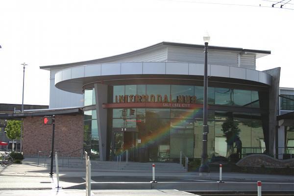
UTA TRAX Light Rail Station (op. 2007)
UTA FrontRunner Commuter Rail Station (op. 2008)
Greyhound Bus Depot
AMTRAK Train Station
UTA FrontRunner Commuter Rail Station (op. 2008)
Greyhound Bus Depot
AMTRAK Train Station
Wikipedia article: http://en.wikipedia.org/wiki/Salt_Lake_City_Intermodal_Hub
Nearby cities:
Coordinates: 40°45'47"N 111°54'33"W
- Interstate 70 Interchange 167 474 km
- Coal Transfer for Navajo Generating Station 483 km
- Silverton Railroad Heritage Park 492 km
- Durango & Silverton Narrow Gauge Railroad 522 km
- BNSF Denver 38th St. Yard 597 km
- Williams Depot - Grand Canyon Railway 614 km
- La Posada Historic District 648 km
- Cedarwood 701 km
- Abandoned Track-Bed 763 km
- Playas Siding 1022 km
- Salt Lake Central Business District 0.7 km
- Interstate 80/Interstate 15 Interchange 0.7 km
- The Church of Jesus Christ of Latter-day Saints: World Headquarters 1.7 km
- Utah State Fairpark 1.7 km
- Poplar Grove Neighbourhood 1.8 km
- Fairpark Neighbourhood 2 km
- Capitol Hill Complex 2.4 km
- Jordan Meadows Neighbourhood 2.9 km
- Glendale Neighbourhood 3.3 km
- The Avenues 3.7 km