Location of original swing bridge
USA /
Illinois /
Peru /
World
/ USA
/ Illinois
/ Peru
destroyed, historical layer / disappeared object, 19th century construction
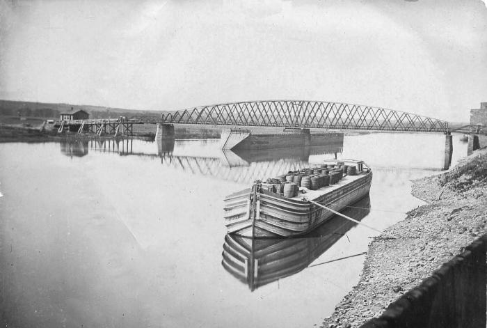


*per Sanford map of Peru, IL circa 1890’s
Nearby cities:
Coordinates: 41°19'20"N 89°7'33"W
- Lexington site 1059 km
- Former Site of Rosewood 1457 km
- Indiantown Cogeneration Plant - Coal Fired Generator 1774 km
- Sand Banks 1982 km
- Marblehead lime plant(abandoned) 1984 km
- 'Arch Oboler Residence' by Frank Lloyd Wright 2723 km
- Malibu Country Club (Closed) 2724 km
- Saint George's Hill (abandoned + destroyed) 3758 km
- Harris (destroyed) 3759 km
- Gages (destroyed place) 3759 km
- Illinois Valley Regional Airport-Walter A Duncan Field (VYS/KVYS) 3.9 km
- Interstate 80 Interchange 79 7.5 km
- Buzzi Unicem USA 7.9 km
- Wal-Mart Retail Support Center 8.8 km
- Matthiessen State Park 9 km
- Lafarge Aggregates 9 km
- Starved Rock State Park 11 km
- Pleasant Creek Campground 14 km
- Troy Grove, Illinois 16 km
- Donnelley/DePue State Park 17 km