Fira
Greece /
Kiklades /
Thira /
World
/ Greece
/ Kiklades
/ Thira
, 0 km from center (Θήρα)
World / Greece / Notio Aigaio
village, resort


Firá (modern Greek: Φηρά, pronounced [fi.'ra]) is the modern capital of the Greek Aegean island, Santorini. A traditional settlement,"Firá" derives its name from an alternative pronunciation of "Thíra", the ancient name of the island itself.
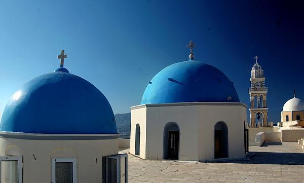
Fira is a city of white-washed houses built on the edge of the 400 metres (1,312 feet) high caldera on the western edge of the semi-circular island of Thera. The two main museums of interest are the Archaeological Museum of Thera, 30 metres (98 feet) east of the cable car entrance, and the Museum of Prehistoric Thera at the southeast corner of the White Orthodox Cathedral of Ypapanti, built on the site of an earlier church destroyed in the 1956 earthquake.
Access to Fira is mainly by roads on its eastern side, climbing from its port via the Z-shaped footpath on foot or on donkeys, or by riding the steep cable car from its lower terminal by the port. The central square of Fira is called Plateia Theotokopoulou, with a bus and taxi station, banks, and pharmacies.
From Fira there is a panoramic view of the 18 kilometres (11 miles) long caldera from southern Cape Akrotiri to northern Cape Ag. Nikolaos, plus the volcanic island Nea Kameni at the center with Thirassia Island in the Aegean. Large cruise ships anchor in the small harbor between Nea Kameni and Fira.
Every day during the summer, Fira is a bustling metropolis as cruise ships from all over the Mediterranean and Aegean seas descend. As a result, prices in Fira (and Santorini generally) tend to be a little higher than other Greek Islands. When there are several ships in port, the lines at the cable cars connecting the Old Port, where the cruise ship tenders dock, with the town of Fira on top of the cliff may become very long.
Wikipedia article: http://en.wikipedia.org/wiki/Fira
Nearby cities:
Coordinates: 36°25'13"N 25°25'58"E
- Emporio 6.2 km
- Livadi 82 km
- Hersonissos 122 km
- Hersonissos 123 km
- Ferma 160 km
- Koutsounari 160 km
- Xerokambos 168 km
- Gennadi 227 km
- Pefkos (or Pefki) 235 km
- Kremasti 240 km
- Santorini 1.8 km
- Perimeter of Thera before Minoan eruption 2.9 km
- Nea Kameni 3.5 km
- Caldera 3.9 km
- Santorini Island (Thira) International Airport 4.6 km
- Palea Kameni 5.5 km
- Prophet Elias Mountain 6.3 km
- Therasia 8.3 km
- Perivolos 8.6 km
- Αghios Georgios 8.9 km
Comments