Conduit
United Kingdom /
England /
Lancaster /
Lancaster Canal Towpath
World
/ United Kingdom
/ England
/ Lancaster
pipe bridge
Add category
Photos:
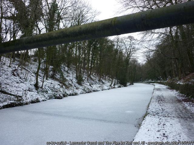
1) www.geograph.org.uk/photo/1657377
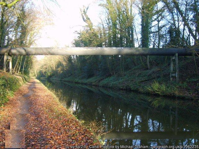
2) www.geograph.org.uk/photo/1062235
It's been here a looong time: maps.nls.uk/geo/explore/side-by-side/#zoom=17&lat=54.02...
1) www.geograph.org.uk/photo/1657377
2) www.geograph.org.uk/photo/1062235
It's been here a looong time: maps.nls.uk/geo/explore/side-by-side/#zoom=17&lat=54.02...
Wikipedia article: https://en.wikipedia.org/wiki/Lancaster_Canal
Nearby cities:
Coordinates: 54°1'22"N 2°48'25"W
- Knostrop Fall Lock Pipe Bridge 89 km
- Water Pipe 294 km
- Water Pipe 295 km
- Ameralik Fjord Powerline Span 2903 km
- Suspended pipeline 5520 km
- Pipeline crossing 5822 km
- Greenup Pipeline Bridge 6035 km
- Pipeline bridge 6625 km
- Pipeline bridge 6776 km
- Old Trails Arch Bridge 8192 km
- Lancaster University 2 km
- Caton Moor Wind Farm 11 km
- Kellet Quarries 11 km
- Pine Lake Resort, Lancaster 14 km
- Grizedale Forest 16 km
- Leighton Moss 16 km
- Morecambe Bay 16 km
- Central point of Great Britain 17 km
- Bentham Golf Club 23 km
- Yorkshire Dales National Park 47 km