Bridge
United Kingdom /
England /
Carterton /
East Gloucestershire Railway Footpath
World
/ United Kingdom
/ England
/ Carterton
road bridge
Add category
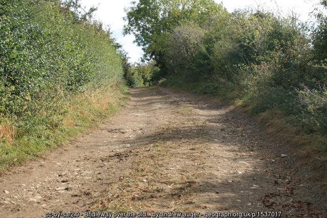
Carries a bridleway over the route of the former East Gloucestershire Railway. The arch of the bridge has been infilled according to www.fairfordbranch.co.uk/Alvescot.htm
Photo: www.geograph.org.uk/photo/1537017
Photo: www.geograph.org.uk/photo/1537017
Wikipedia article: https://en.wikipedia.org/wiki/Oxford,_Witney_and_Fairford_Railway#The_East_Gloucestershire_Railway
Nearby cities:
Coordinates: 51°43'45"N 1°36'36"W
- Abbey Bridge and Viaduct 46 km
- Clopton Bridge 52 km
- Worcester Bridge 67 km
- Blythe Valley Business Park exit bridge 73 km
- Chepstow Road Bridge 74 km
- Widney Manor Road bridge over M42 75 km
- Heath Crescent Bridge 5b, Coventry Canal 78 km
- M6 Motorway Bridge, Coventry Canal 81 km
- Small Heath Bridge 84 km
- Monument Road bridge 87 km
- RAF Brize Norton 3 km
- Runway 08/26 3 km
- Filkins and Broughton Poggs Civil Parish 3.4 km
- Kencot Hill Solar Field 4.1 km
- Kencot Hill Solar Field 4.5 km
- Cotswold Wildlife Park 5.5 km
- Burford Golf Club 8.1 km
- Southrop airfield 9 km
- Budgehill Wood 13 km
- Cotswolds 18 km