Sombrero Island Lighthouse
Anguilla /
Sandy Ground /
World
/ Anguilla
/ Sandy Ground
/ Sandy Ground
lighthouse, 2001_construction
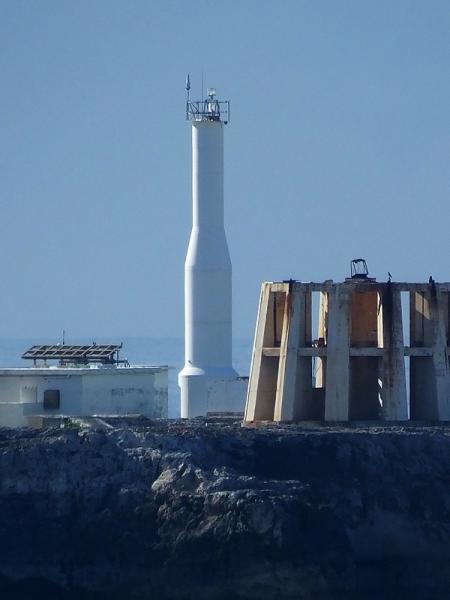
Sombrero Lighthouse is a lighthouse that marks the Anegada Passage, which is the route from Europe into the Caribbean. The lighthouse is located near the centre of Sombrero island, and reaches a height of almost 51 metres (167 ft) a.s.l.
www.ibiblio.org/lighthouse/aia.htm
marinas.com/view/lighthouse/4va1vx_Sombrero_Light_Light...
www.ibiblio.org/lighthouse/aia.htm
marinas.com/view/lighthouse/4va1vx_Sombrero_Light_Light...
Wikipedia article: http://en.wikipedia.org/wiki/Sombrero_Lighthouse
Nearby cities:
Coordinates: 18°35'11"N 63°25'35"W
- Phare Du Gosier 336 km
- Arecibo Lighthouse 346 km
- Punta Borinquen Lighthouse (1920) 393 km
- Los Morrillos Lighthouse 405 km
- RIncón Lighthouse 407 km
- Gun Hill Signal Station 734 km
- Cayo de Agua Lighthouse 842 km
- Cayo Herradura Lighthouse 870 km
- Light House, Chacachacare Island, Trinidad 896 km
- Farallón Centinela 911 km
- Sombrero 0.2 km
- epicenter of m3.2 quake 32 km
- epicenter of m2.8 quake 38 km
- Epicenter of m3.5 quake 42 km
- Anegada Passage 43 km
- epicenter of 3.2 quake 44 km
- epicenter of m2.9 quake 56 km
- epicenter of m2.8 quake 58 km