Montauk Air Force Station AN/FPS-35 Radar
USA /
New York /
Montauk /
World
/ USA
/ New York
/ Montauk
World / United States / Connecticut
military, radar station, historic landmark

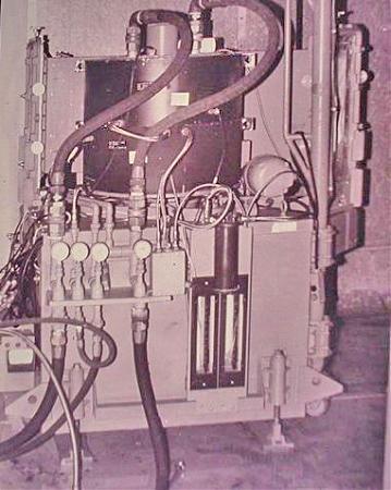

The AN/FPS-35 radar was a long range radar used in the early 1960s.
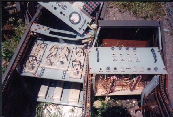
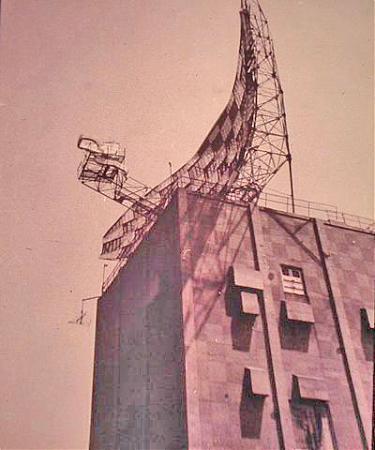
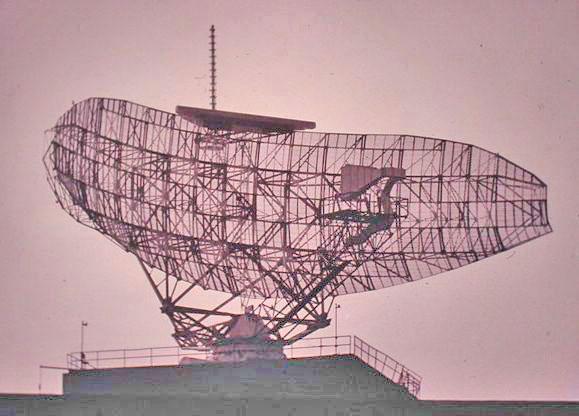
Sperry Corporation built 12 long range radars (picking up objects 200 miles away) in the 1960s to succeed existing Semi Automatic Ground Environment (SAGE) to provide enhanced electronic counter countermeasures (ECM). The systems operated at 420 to 450 MHz. The antennas weighed 70 to 80 tons and had numerous problems. The concrete tower bases were 80 feet high.
The prototype was developed at the Thomasville Aircraft Control and Warning Station in Thomasville, Alabama. All of the radars have been dismantled except for the one at Camp Hero on the eastern tip of Long Island, New York. Boaters on Long Island Sound lobbied to save it since the massive radar was a better landmark than the Montauk Point Lighthouse.
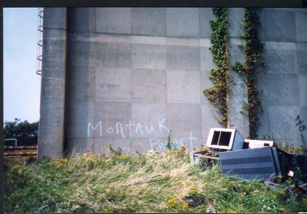
The radar complex is now part of Camp Hero State Park which adjoins Montauk Point State Park. The radar has worked its way into an urban legend that it was used in time travel experiments called the Montauk Project. The structure is listed on the National Register of Historic Places.
www.radomes.org/museum/equip/fps-35.html
Sperry Corporation built 12 long range radars (picking up objects 200 miles away) in the 1960s to succeed existing Semi Automatic Ground Environment (SAGE) to provide enhanced electronic counter countermeasures (ECM). The systems operated at 420 to 450 MHz. The antennas weighed 70 to 80 tons and had numerous problems. The concrete tower bases were 80 feet high.
The prototype was developed at the Thomasville Aircraft Control and Warning Station in Thomasville, Alabama. All of the radars have been dismantled except for the one at Camp Hero on the eastern tip of Long Island, New York. Boaters on Long Island Sound lobbied to save it since the massive radar was a better landmark than the Montauk Point Lighthouse.
The radar complex is now part of Camp Hero State Park which adjoins Montauk Point State Park. The radar has worked its way into an urban legend that it was used in time travel experiments called the Montauk Project. The structure is listed on the National Register of Historic Places.
www.radomes.org/museum/equip/fps-35.html
Wikipedia article: https://en.wikipedia.org/wiki/AN/FPS-35
Nearby cities:
Coordinates: 41°3'43"N 71°52'26"W
- Camp Hero State Park 2.1 km
- Fort H.G. Wright 26 km
- General Dynamics Electric Boat Division shipyard 37 km
- United States Coast Guard Academy 40 km
- Camp Niantic 40 km
- Naval Submarine Base New London 43 km
- 103rd Air Control Squadron 97 km
- Bradley Army National Guard 119 km
- Connecticut Air National Guard 120 km
- Bradley International Airport (BDL/KBDL) 121 km
- Lake Montauk 4.2 km
- Montauk, New York 6.9 km
- Montauk Beach 7.4 km
- Fort Pond Bay 8.1 km
- Hither Woods / Lee Koppelman Nature Preserve 10 km
- Napeague Harbor 16 km
- Town of East Hampton 17 km
- The Race 25 km
- Southold, New York 33 km
- Suffolk County, New York 69 km