Solar tower
USA /
New Mexico /
Carnuel /
World
/ USA
/ New Mexico
/ Carnuel
tower, solar power station / farm (photovoltaic), solar energy products company
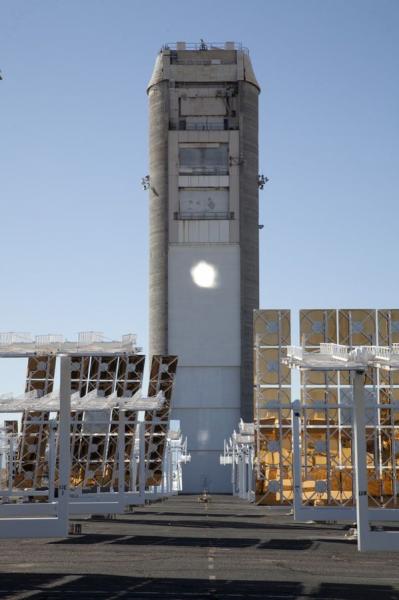
The tower is a 61 m (200 ft) high concrete structure with three test locations on the north side and the top of the tower.
Wikipedia article: https://en.wikipedia.org/wiki/National_Solar_Thermal_Test_Facility
Nearby cities:
Coordinates: 34°57'44"N 106°30'34"W
- KXST-AM Transmitter Park 786 km
- KSL AM Radio Broadcast Towers 813 km
- KHCC-FM 856 km
- KMUW-FM 864 km
- KICT-FM 864 km
- Path 26 Design Switch 1110 km
- Observation Peak 1362 km
- KBRG and KSQL Radio Site 1397 km
- WABG-TV Tower 1479 km
- Eastbound I-74: Spoon River Rest Stop and observation tower 1581 km
- National Solar Thermal Test Facility (NSTTF)
- Base Exercise Evaluation Skills Training Area 2 km
- Open Detonation Treatment Facility 3.5 km
- Manzano Weapons Storage Entrance Area 4.7 km
- Kirtland Air Force Base (ABQ/KABQ) 5.3 km
- Manzano Base 6 km
- Tijeras Arroyo Golf Course (Military) 6.7 km
- DOE Live-Fire Range 7.4 km
- Sandia National Labs Aerial Cable Site 9 km
- Manzano Mountians 24 km
National Solar Thermal Test Facility (NSTTF)
Base Exercise Evaluation Skills Training Area
Open Detonation Treatment Facility
Manzano Weapons Storage Entrance Area
Kirtland Air Force Base (ABQ/KABQ)
Manzano Base
Tijeras Arroyo Golf Course (Military)
DOE Live-Fire Range
Sandia National Labs Aerial Cable Site
Manzano Mountians