Glascarnoch Dam
United Kingdom /
Scotland /
Strathpeffer /
A835
World
/ United Kingdom
/ Scotland
/ Strathpeffer
dam
Add category
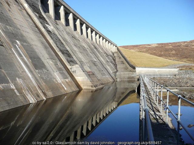
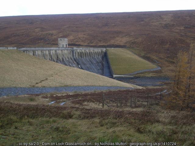
James Williamson and Partners (engineers for the North of Scotland Hydro Electric Board technical panel), 1957. Prominent large curved dam flanked by turfed earth fill wings; central control tower and central fixed spillway with vehicular access road oversailing. Concrete mass gravity construction with rammed earth wings. Battered downstream face with concrete upstand walls to spillway. Tapered concrete piers, with single larger rectangular pier to centre above dispersal valve, support roadway with plain parapet above fixed spillway. Category B Listed: portal.historicenvironment.scot/designation/LB51706
Photos:
1) www.geograph.org.uk/photo/688457
2) www.geograph.org.uk/photo/1410724
Photos:
1) www.geograph.org.uk/photo/688457
2) www.geograph.org.uk/photo/1410724
Wikipedia article: https://en.wikipedia.org/wiki/List_of_dams_and_reservoirs_in_United_Kingdom#Highland
Nearby cities:
Coordinates: 57°41'45"N 4°46'38"W
- Laggan Dam 90 km
- Treig Dam 94 km
- Cruachan Dam 145 km
- Keldua Dam 970 km
- Ufsar Dam 974 km
- Desjarárstífla Dam 995 km
- Spillway 996 km
- Kárahnjúkastífla Dam 997 km
- Blönduvirkjun dam 1149 km
- Árbæjarstífla 1161 km
- Loch Glascarnoch 3.3 km
- Lochluichart Wind Farm 4.4 km
- Loch Luichart 10 km
- Ben Wyvis, 1,046 m (3,432 ft) 12 km
- Loch Garve 13 km
- Loch Fannich 14 km
- Loch Achilty 17 km
- Loch Achonachie 19 km
- Fairburn Wind Farm 20 km
- Orrin Reservoir 21 km