Wailupe Community Center (Honolulu, Hawaii)
| recreation area / ground, Second World War 1939-1945, United States Coast Guard, radio station, United States Navy, housing complex
USA /
Hawaii /
Honolulu /
Honolulu, Hawaii /
Kalanianaole Highway
World
/ USA
/ Hawaii
/ Honolulu
recreation area / ground, Second World War 1939-1945, United States Coast Guard, radio station, United States Navy, housing complex
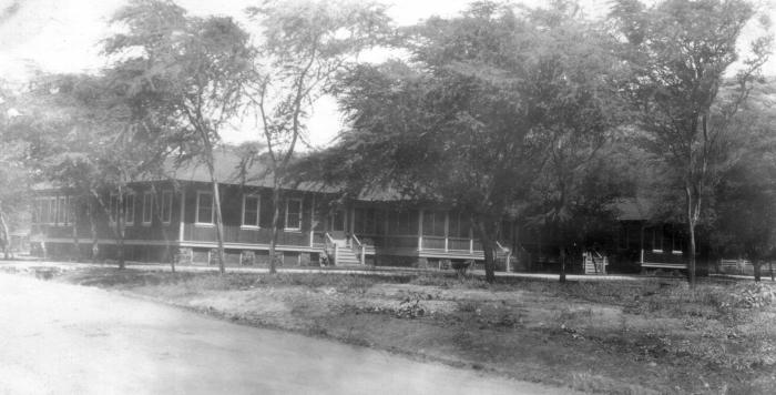
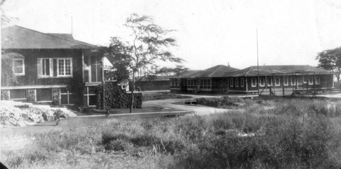
Formerly the site of U.S. Naval Radio Receiver Site, Wailupe (NPM) from 1919 to 10-17 December 1941 when all equipment was moved to Wahiawa due to the attack of Pearl Harbor. When the first part of the station was completed in 1919, the radio crews from Kahuku and Koko Head moved here so their stations could be remodeled. Wailupe was completed in 1921. Uniquely, its operations building was located over the water so the land could be used for officer quarters, three duplex quarters, and the single men's barracks.
The U.S. Coast Guard took over the property in 1942, when it became a training station. One of the most important schools at the Training Station was the 16-week Radioman School. It became U.S. Coast Guard Radio Station, Honolulu (NMO) in 1943.
In November 1943, the Coast Guard assumed control of all inter-island communications for the Navy. As a result of the increased traffic, a new primary radio station was constructed on the site of the Wailupe Training Station.
However, the Coast Guard felt “the site of the present District primary radio station at Wailupe is far from satisfactory because of lack of space and the character of the terrain which prevents the proper separation of transmitting and receiving antenna systems.”
During the period of September – October 1958, the receiver site and administrative spaces were moved to Wahiawa.
The site continues to be used for housing and recreation by the Coast Guard today.
www.navy-radio.com/commsta/wailupe.htm
www.navy-radio.com/commsta/wailupe-nmo.htm
www.radiomarine.org/gallery/show?keyword=pt1&panel=pab1...
imagesofoldhawaii.com/wailupe-naval-radio-station/
Nearby cities:
Coordinates: 21°16'38"N 157°45'37"W
- Runway 04/22L 33 km
- Former Naval Air Station Barbers Point 35 km
- Naval Computer and Telecommunications Area Master Station Pacific (NCTAMS PAC) 39 km
- CAMSPAC, Point Reyes Operations and Receiver Site (NMC) 3820 km
- United States Coast Guard Sitkinak LORAN A/C Station 3937 km
- US Coast Guard Air Station Kodiak 4082 km
- US Coast Guard Station Kodiak 4082 km
- United States Coast Guard Communications Command Kodiak 4086 km
- USCG Group/Air Station Port Angeles 4274 km
- USCG LORAN-C Station, Searchlight 4450 km
- Waialea Iki 1.3 km
- Maunalua Bay 1.4 km
- Aina Haina Valley 1.6 km
- Koko Head 6.5 km
- Kamilo Nui Valley 7 km
- Hawai'i Kai 7.8 km
- Honolulu, Hawaii 7.8 km
- Koko Head Regional Park 8 km
- Molokai/Kaiwi Channel 31 km
- Oʻahu 31 km