Šum waterfall (Згорнья Бесница)
Slovenia /
Gorenjska /
Kropa /
Згорнья Бесница
World
/ Slovenia
/ Gorenjska
/ Kropa
waterfall
Add category
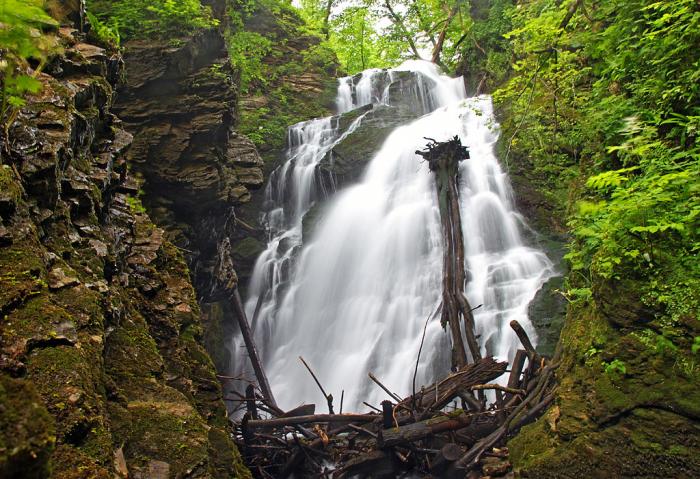
The here described Šum waterfall is situated on the Nemiljščica creek, near Zgornja Besnica, and should be distinguished from the Šum waterfall on the Radovna river.
The Šum waterfall on Nemiljščica has an altitude of ca. 20 m and, depending on the season, quite a lot of water. The easiest route to the waterfall comes from the Nova vas village, near Zgornja Besnica. From the main road good inscriptions are directing us down into the gorge (15 minutes). The path is quite steep, but is in the last, steepest part well protected by a wooden fence.
The visit of Šum waterfall is incorpoprated into the 'Besnica Learning Path (Učna pot Besnica), called also the "Rovnik-slap Šum path". That's a circular path which in addition to the waterfall visits also the nearby karst hill Rovnik, in which there are a few karst caves (with some decoration) and on the hill there's also a place where oligocene fossiles were discovered.
It's interesting as well that above the Šum waterfall once the warm water source was captured. The spa was mentioned already centuries ago, a basin was buil in 1954, but today the place is completely abandoned.
Nearby cities:
Coordinates: 46°16'17"N 14°16'0"E
- Voje Valley 31 km
- Kitzlochklamm 151 km
- cascata di Nardis 275 km
- Roški slap area 295 km
- Skradinski Buk 305 km
- Rhine Falls 457 km
- Wild Hole 476 km
- Grand Vista & Cascade of Caserta 576 km
- Cascades du Hérisson 647 km
- Cirque de St-Même 657 km
- Tenetiše dump 5.9 km
- Slovenian military base 7.1 km
- Kranj Old Town 7.8 km
- GOODYEAR SAVA 8 km
- Huje 8 km
- Planina 1 8.4 km
- iskraTEL 8.5 km
- Planina Jug 8.7 km
- ex JNA streliste 8.8 km
- military 11 km