Cape Cod Air Force Station AN/FPS-123 PAVE PAWS Radar
USA /
Massachusetts /
Sagamore /
Flat Rock Road
World
/ USA
/ Massachusetts
/ Sagamore
World / United States / Massachusetts
military, radar station
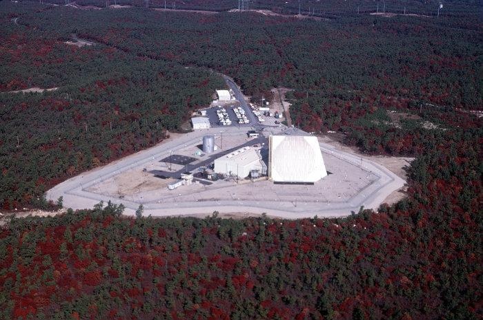
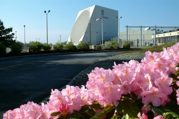
The AN/FPS-123 PAVE PAWS radar has a range of over 3,000 kilometers and a resolution of ~10 centimeters. Its main mission is to track space debris and Intercontinentals as well as Submarine-launched ballistic missiles. It also tracked USA-193 before it was shot down. Its secondary mission is tracking Earth-orbiting objects such as the International Space Station, the Space Shuttle, any object that deviates from its known orbit, or any new orbiting objects. The Cape Cod PAVE PAWS is manned by the 6th Space Warning Squadron.
Wikipedia article: http://en.wikipedia.org/wiki/PAVE_PAWS
Nearby cities:
Coordinates: 41°45'9"N 70°32'18"W
- Cape Cod Air Force Station 0.8 km
- Joint Base Cape Cod (Massachusetts Military Reservation) 4.7 km
- Otis Air National Guard Base (FMH/KFMH) 8.5 km
- Naval Station Newport 70 km
- NUWC - Naval Undersea Warfare Center 70 km
- Coaster's Harbor Island - US Naval War College 71 km
- Quonset Point Airport 76 km
- The home of the "Quonset hut" 77 km
- Camp Fogarty, US Army National guard 82 km
- Ninigret Park, Naval Auxiliary Air Station Charlestown 104 km
- Cape Cod Canal 1.7 km
- United States Coast Guard Communication Station, Boston (NMF) 5.4 km
- Monument Beach 6.8 km
- Pocasset, Massachusetts 11 km
- Otis Air National Guard Base (FMH/KFMH) 11 km
- Wings Neck 11 km
- Mashpee-Wakeby Pond 11 km
- Wareham, Massachusetts 13 km
- Town of Plymouth 17 km
- Town of Falmouth, Massachusetts 19 km