Decumanus (Anjar)
Lebanon /
al-Biqaa /
Zahhlah /
Anjar
World
/ Lebanon
/ al-Biqaa
/ Zahhlah
, 10 km from center (زحلة)
road
Add category
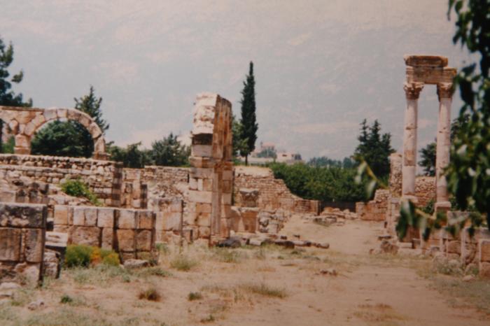
east-west main street of the city duilt in roman period
Nearby cities:
Coordinates: 33°43'56"N 35°56'0"E
- mara'ba road 33 km
- Petroleum Road 71 km
- Completed section of road 103 km
- Mostly-completed section of road 105 km
- Unfinished section of road 106 km
- Road being widened 107 km
- Unfinished section of road 115 km
- Road to Aleppo Int. Airport 299 km
- Diyarbakır Railway 606 km
- Jurf Al Sakhar 753 km
- Anjar municipality 0.7 km
- Majdel Anjar municipality 2.7 km
- Bar Elias municipality 5.3 km
- Kfar Zabad municipality 5.6 km
- Muallaqa dependencies 11 km
- Zahle-Muallaqa-Taanayel municipality 12 km
- Al-Dimas Subdistrict (Nahiyah) 13 km
- Western Bekaa District 19 km
- Mount Lebanon Governorate 27 km
- Rif Dimashq Governorate (PCS) 112 km