Itu Aba Island
Philippines /
Southern Tagalog /
Taburi /
World
/ Philippines
/ Southern Tagalog
/ Taburi
World
island
Add category


Occupied by Taiwan since 1956.
Area: 46 hectares
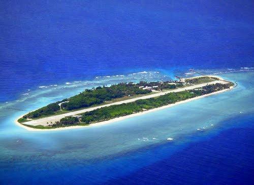
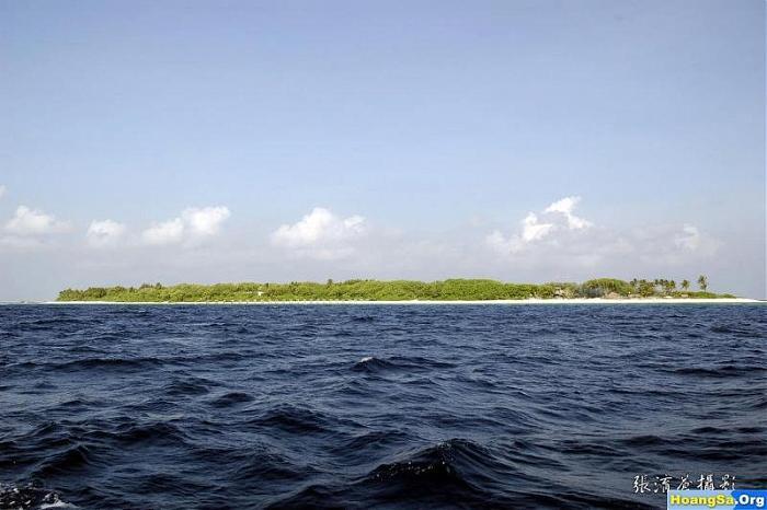
The largest of the Spratly islands. Covered with shrubs, coconut and mangroves. 600 soldiers stationed, lighthouse, radio and weather stations, concrete landing jetty and two wells at the SW end. Guano deposits, fringing reef. The now only 1150-meters-long airstrip was completed in January 2008. Pineapple was once cultivated here. Occupied since September 1956, four months after Filipino Tomas Cloma claimed the islands.
Area: 46 hectares
The largest of the Spratly islands. Covered with shrubs, coconut and mangroves. 600 soldiers stationed, lighthouse, radio and weather stations, concrete landing jetty and two wells at the SW end. Guano deposits, fringing reef. The now only 1150-meters-long airstrip was completed in January 2008. Pineapple was once cultivated here. Occupied since September 1956, four months after Filipino Tomas Cloma claimed the islands.
Wikipedia article: http://en.wikipedia.org/wiki/Itu_Aba_Island
Nearby cities:
Coordinates: 10°22'32"N 114°21'55"E
- Tizard Bank 21 km
- Kalayaan 86 km
- Jackson Reef 147 km
- Spratly Islands 164 km
- Balabac Island, Palawan 381 km
- Balambangan Island 433 km
- Banggi Island 447 km
- Malawali Island 485 km
- Pulau Jambongan 518 km
- Pulau Timbang 642 km
- Tizard Bank 15 km
- Union Bank and Reefs 59 km
- Loaita Bank 64 km
- Kalayaan 76 km
- Benitez Reef 79 km
- Livock Reef 105 km
- Fiery Cross Reef 175 km
- Alison Reef 180 km
- Cornwallis South Reef 186 km
- Cay Marino 209 km
Comments