Askari IV (Faisal Cantonment)
Pakistan /
Sind /
Karachi /
Faisal Cantonment /
Rashid Minhas Road
World
/ Pakistan
/ Sind
/ Karachi
World / Pakistan / Sind / Karachi
military, residential area
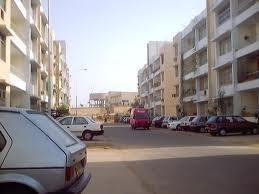
Army housing scheme
Nearby cities:
Coordinates: 24°53'49"N 67°7'15"E
- Gulistan-e-Jauhar 4.8 km
- Mahmoodabad Area 6.9 km
- Gulshan-e-Iqbal 7.5 km
- Nazimabad 11 km
- North Nazimabad 13 km
- Gulshan-e-Maymar 15 km
- Ittehad Town 20 km
- Gulshan-e-Zia 20 km
- Taiser Town 21 km
- Surjani Town 22 km
- Army Storage Area 0.9 km
- Gulistan-e-Jauhar Block 19 1 km
- Naval Colony 1.1 km
- Gulistan-e-Jauhar Block 18 1.2 km
- AWC Residential Area 1.5 km
- Drigh Colony 1.7 km
- Gulshan-e-Iqbal Block 10A 1.9 km
- Karachi Golf Club 2.1 km
- Shanti Nagar 2.2 km
- Karsaz 2.4 km
Comments