Helipad (Sangrah)
India /
Himachal Pradesh /
Nahan /
Sangrah /
MDR 1
World
/ India
/ Himachal Pradesh
/ Nahan
helipad
Add category
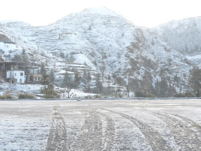
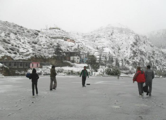
Jawga Helipad/ Sangrah Hills is one of most beautiful place of the Sangrah valley. Helipad is situated at the top of Sangrah town and peoples often come to walk in morning and evening here. Panoramic view of Snow-covered Chooddhar hills looking amazing from the Helipad. Sangrah is a Beautiful Town, Green Valley and Sub-Division of District Sirmour, Himachal Pradesh. Sangrah Town is about 358 K.M. from Delhi, 161 K.M. from Shimla, 152 K.M. from Chandigarh, 65 K.M. from Rajgarh, 63 K.M. from Nahan and 25 K.M. from Renuka Ji (By Road). Government Degree College Sangrah, SDM Office,Tehsil Office, BDO, HDO, ADO, BSNL Exchange, Police Station, Old House of National Awarded Kinkri Devi, Jawga Hils, Jawga Helipad, Rawlagarh Fort, Brah Forest, Bhagwan Parshuram Music School, Lord Vijat and Shiva Temple are the main attraction/Place of Sangrah. There are 41 Gram Panchayats in Sangrah Development Block and Sub-Division. About 21 Panchayats of Sangrah Block has been covered with the Snow during winter season. Churdhar Hills, Jablog, Piulilani, Haripurdhar, Gattadhar, Balayandhar, Sunderdhat, Brah-Rupee, Jawga Hills, Choras and Diwri-Khrahan are the Snow bounded Area/ Hills/ Panoramic Valley/ Village/ Forest of Sangrah Block in winters. Population of Sangrah Sub-Division is abuut 71,000 and height is 6,700 Feet. Budechhu, Dhakuli, Nati, Geeh, Thoda Fight and Purua are the Famous Folk Dance of this area.
Sangrah, Himachal Pradesh-173023, India.
Sangrah, Himachal Pradesh-173023, India.
Nearby cities:
Coordinates: 30°41'38"N 77°25'59"E
- Heliport 221 km
- Heliport 250 km
- Military land (helipad) 360 km
- Camp with Helipad 534 km
- Taxiway + helipad 540 km
- Emrgency air strip And helipades Surian cant. 707 km
- Helipad of Ujjain 855 km
- Vibrant Festival Place - Helipad, Gh 4, Gandhinagar 957 km
- Suktara Air strip and Helipad 995 km
- Kancharapara Airstrip-1800 mtr 1394 km
- Brahawtar Forest 1.2 km
- SARWA HILLS 5.9 km
- Sharma Village Chilga 6 km
- THEER DHAR 6.8 km
- Bharayan Chaman Village 7 km
- BHAJAI DHAR AREA 7.6 km
- CHARNA 9 km
- Renuka Lake 10 km
- Tape Ka Tila, Dadhahu, Renuka ji 10 km
- Osho Farms,Village Chaingan 11 km