Road Bridge
United Kingdom /
Scotland /
Errol /
World
/ United Kingdom
/ Scotland
/ Errol
road bridge
Add category
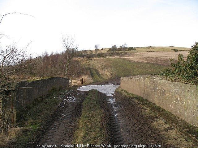
Carries a farm access track over the course of the dismantled Newburgh and North Fife Railway.
Photo: www.geograph.org.uk/photo/1154575
Photo: www.geograph.org.uk/photo/1154575
Wikipedia article: https://en.wikipedia.org/wiki/Newburgh_and_North_Fife_Railway
Nearby cities:
Coordinates: 56°20'24"N 3°11'15"W
- Saint Leonard's Bridge 17 km
- Forth Road Bridge 39 km
- North Bridge 43 km
- Clackmannanshire Bridge 45 km
- Kincardine Bridge 46 km
- Dalmuir Drop Lock 36a on the Forth and Clyde Canal 91 km
- Queen Elizabeth Bridge 111 km
- Bridge over the River Morar 175 km
- Dornie Bridge 176 km
- Kylesku Bridge 240 km
- Fife Council 12 km
- Tullis Russel Paper Mill 15 km
- Lochelbank Wind Farm 15 km
- Glenrothes Golf Course 17 km
- Loch Leven 19 km
- Scottish Gliding Union Portmoak 19 km
- Ballingry 21 km
- RSPB Loch Leven Centre at Vane Farm 21 km
- Former RAF Balado Bridge , Baldo Poultry Farm 22 km
- Perth and Kinross Council 48 km