Mount June
USA /
Oregon /
Lowell /
World
/ USA
/ Oregon
/ Lowell
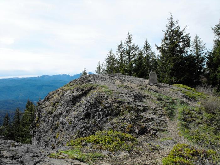
Mount June is a forested peak in the western Old Cascades of Oregon. Its summit stands 4618 feet asl, and like many prominent Oregon peaks was once the site of a fire lookout. The first lookout was a pole platform built in the 1920s, which was replaced with an L4 tower in 1934. The structure was destroyed in 1967. A good trail leads to the summit of Mount June.
Nearby cities:
Coordinates: 43°47'24"N 122°43'31"W
- Dexter Dam 17 km
- Railroad in "Stand by Me" 20 km
- Lane County Dump Site 30 km
- Spencer's Butte 38 km
- Doukhobor commune 1923-1928, Eugene OR 49 km
- Coyote Prairie 51 km
- Fern Ridge / Coyote Creek Wildlife Area 54 km
- Zumwalt Dog Park 56 km
- Murphy Plywood 66 km
- Cleveland Hill 83 km
- Sawtooth Rock 2 km
- Lookout Point Lake 10 km
- Dorena 13 km
- Dorena Lake 16 km
- Cerro Gordo 19 km
- Cottage Grove State Airport 25 km
- Middlefield Golf Course 25 km
- North Regional Park 26 km
- Shortridge Butte 27 km
- Cottage Grove Lake 29 km