Kananga, Leyte (Rizal)
Philippines /
Eastern Visayas /
Kananga /
Rizal
World
/ Philippines
/ Eastern Visayas
/ Kananga
World / Philippines / Leyte / Kananga
municipality, draw only border
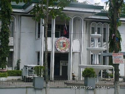
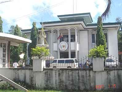
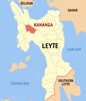
Kananga is a 2nd class municipality in the province of Leyte, Philippines. According to the 2000 census, it has a population of 42,866 people in 8,665 households.
Kananga is one of the 41 municipalities in the province Leyte. It is about 86 kilometers or approximately two hours ride to the City of Tacloban, the provincial capital of Leyte and more or less twenty to twenty five minutes ride to the City of Ormoc.
Kananga is one of the 41 municipalities in the province Leyte. It is about 86 kilometers or approximately two hours ride to the City of Tacloban, the provincial capital of Leyte and more or less twenty to twenty five minutes ride to the City of Ormoc.
Wikipedia article: http://en.wikipedia.org/wiki/Kananga,_Leyte
Nearby cities:
Coordinates: 11°10'34"N 124°34'6"E
- Claveria, Misamis Oriental 257 km
- Impasug-ong Bukidnon 290 km
- Talakag, Bukidnon 321 km
- Kapalong 366 km
- Carmen, Cotabato 407 km
- Baganga, Davao Oriental 420 km
- Banaybanay, Davao Oriental 459 km
- Malungon, Sarangani 519 km
- Lake Sebu, South Cotabato 534 km
- Jose Abad Santos, Davao Occidental 577 km
- Larrazabals FArm 3.4 km
- Rizal Airstrip 3.7 km
- Brgy. Maticaa, Ormoc City 4.9 km
- HISUMCO Sugar Company, Inc. 5.1 km
- purok 7 5.1 km
- Upper Mahiao Geothermal Plant 6.6 km
- EDC / NPC HOUSING VILLAGE 7.5 km
- Valencia 7.9 km
- TABUK, KA DECOY, SANJOSE, ORMOC CITY, LEYTE 8.1 km
- Brgy. San Jose Proper 8.8 km
Comments