Jeokbyeok River Cliffs (Byeonsan-myeon)
Korea (South) /
Chollabuk /
Puan /
Byeonsan-myeon /
Sutong-ri, 700-56
World
/ Korea (South)
/ Chollabuk
/ Puan
cliff
Add category
Jeokbyeok River Cliffs
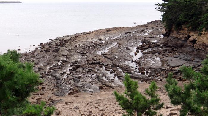
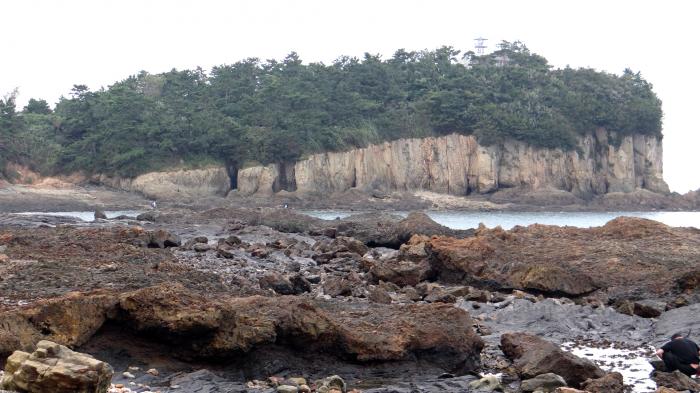
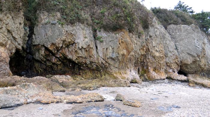
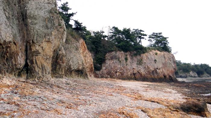
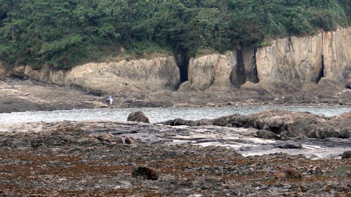
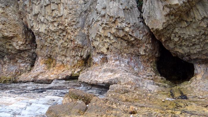
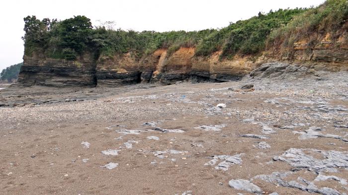
"Jeokbyeok" means "Red Walls" in Korean because the rocks are red and below the water there is a wall like cave at the cliffs. The Jeokbyeok River is part of Geum River that flows below these cliffs. The river flows through steep mountains called "Jeokbyeok", and where the river runs under these rugged 30 meter/100 feet high cliffs, it's called the "Jeokbyeok River"
"Jeokbyeok" means "Red Walls" in Korean because the rocks are red and below the water there is a wall like cave at the cliffs. The Jeokbyeok River is part of Geum River that flows below these cliffs. The river flows through steep mountains called "Jeokbyeok", and where the river runs under these rugged 30 meter/100 feet high cliffs, it's called the "Jeokbyeok River"
Nearby cities:
Coordinates: 35°38'12"N 126°27'40"E
- Mt. Golubiny Utyos 841 km
- Xianshui Rocks 1229 km
- Tai Long Tsui/Fung Head 1879 km
- Tsang Pang Kok 1884 km
- Jiajiang Thousand Buddhas Cliff 2239 km
- Lebkhog valley and historic rock images 2696 km
- Casuarina Bluff 3355 km
- Berhala Island 3419 km
- Riotala 3510 km
- Laem Thaen 3899 km
- Gyeokpo-ri 1.7 km
- Byeonsan 7 km
- Naebyeonsan 10 km
- Byeonsanbando National Park 10 km
- Wido 17 km
- Gogunsan Archipelago 18 km
- Seonunsan 18 km
- Sinsido (Sinsi Island) 20 km
- Saemangeum dike 21 km
- Saemangeum 24 km