The Hardanger bridge
Norway /
Hordaland /
Kaland /
Rv13
World
/ Norway
/ Hordaland
/ Kaland
road bridge, suspension bridge
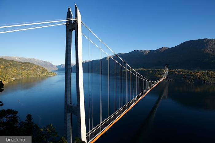
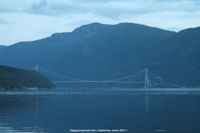
Rv. 13 Hardanger bridge in Ullensvang and Ulvik County in Hordaland.
The Hardanger bridge is built as a 2 lane suspension bridge with lane for bicycles and pedestrians. The bridge have a main span of 1310 m and a total length of 1380 m. The bridge towers elevates to 200 m above sea level.
The project also includes 2675 meter tunnels and 0,8 km of new roads. In addition the project consists of a new bicycle and pedestrian lane of 0,9 km approaching the bridge.
The Hardanger bridge is the longest suspension bridge in Norway. The sailing height under the bridge is 55 m.
(source: www.vegvesen.no/Vegprosjekter/Hardangerbrua/InEnglish )
Wikipedia article: http://en.wikipedia.org/wiki/Hardanger_Bridge
Nearby cities:
Coordinates: 60°28'41"N 6°49'40"E
- Osterøy Bridge 71 km
- Nordhordland Bridge (Nordhordlandsbrua) 86 km
- Askøy Bridge 89 km
- Stord Bridge 113 km
- Frekasundbrua bridge 154 km
- Lysefjord Bridge 178 km
- Drammen Bridge 205 km
- Mjøsa Bridge 214 km
- Varodd Bridges 267 km
- Fredrikstad Bridge 270 km
- Vangsvatnet 30 km
- Lovatnet Lake 30 km
- Jondal 38 km
- Hamlagrøvatnet 38 km
- Gudvanga Tunnel 46 km
- Hardangervidda National Park 49 km
- Nærøyfjorden (The Nærøyfjord) 52 km
- Aurlandsfjorden 57 km
- Gullfjellet 69 km
- Osterøy (island) 71 km