Mount Talang
Indonesia /
Sumatera Barat /
Solok /
World
/ Indonesia
/ Sumatera Barat
/ Solok
mountain, volcano, stratovolcano, mountaineering
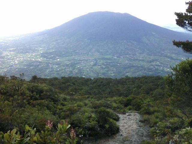

Mount Talang (Indonesian: Gunung Talang) (2,597 m) is an active stratovolcano in West Sumatra, Indonesia. Talang has two crater lakes on its flanks, the largest of which is 1 x 2 km wide and is called Lake Talang.
According to the Smithsonian Institution Global Volcanism Program, Mount Talang has had eight confirmed eruptions between 1833 and 1968. A minor eruption followed in April 2005, over 25,000 inhabitants of the local area being evacuated due to fears of further volcanic eruptions. Geologists say that the eruption in April 2005 is connected to the devastating December 2004 Indian Ocean earthquake.
volcano.si.edu/volcano.cfm?vn=261160
Wikipedia article: http://en.wikipedia.org/wiki/Mount_Talang
Nearby cities:
Coordinates: -0°58'35"N 100°40'32"E
- Giant Volcano - undersea Sumatra 393 km
- Long Island 5168 km
- Newer Volcanics Province 5863 km
- Chyulu Hills 7009 km
- Mount Kenya 7064 km
- Bunyaruguru/Kichwambe Volcanic Field 7868 km
- Pilanesberg Alkaline Ring Complex 8336 km
- Lake Taupo 8656 km
- Maroa Caldera 8669 km
- Volcano Pleiades 9091 km
- Danau Dibawah 7.1 km
- Talang 7.7 km
- KO NAN NAGARI DILAM.... 9 km
- Lake Kembar 11 km
- Arau Hilir Wildlife Sanctuary 15 km
- Nagari Koto Baru, Solok 16 km
- Kanagarian Koto Sani 26 km
- kanagarian pianggu 26 km
- Nagari Muaro Pingai 33 km
- Lembah Anai-Moh Hatta Nature Preserve 37 km