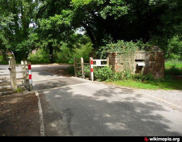
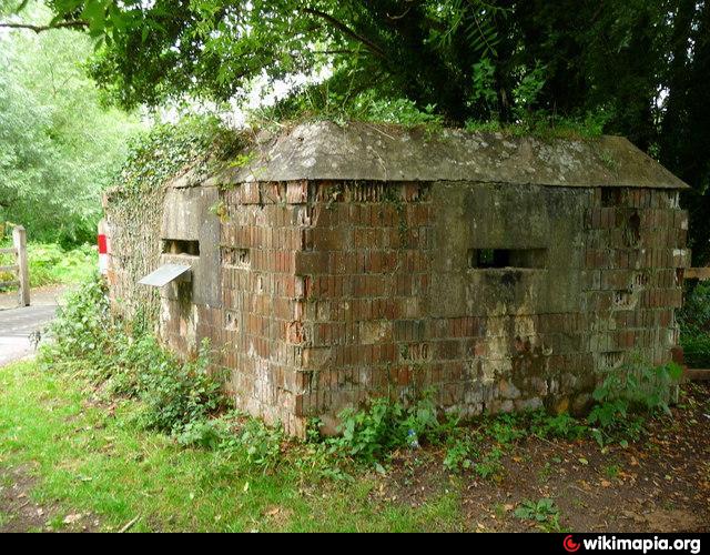
Pillbox
United Kingdom /
England /
Hungerford /
World
/ United Kingdom
/ England
/ Hungerford
pillbox
Add category
Nearby cities:
Coordinates: 51°24'44"N 1°29'44"W
- Position of two World War 2 Pillboxes 89 km
- WW2 Pillbox 117 km
- Tank Gun Pillbox 140 km
- Jäger stand 194 km
- Pillboxes 582 km
- Bunker and trenches 1188 km
- Department of Motor Vehicles 7028 km
- Fuerte de San Carlos 7688 km
- Pithouse Ruin 8297 km
- California Highway Patrol - Rainbow Inspection Facility (686) 8698 km
- Hungerford Park 0.7 km
- Denford Park 1.2 km
- Gorunds of Littlecote House Hotel 5.1 km
- Welford Park 7.2 km
- Membury Camp 8.6 km
- RAF Membury 8.8 km
- Membury Service Station 8.9 km
- USAF Welford NMSA 9 km
- RAF Welford 9 km
- Chaddleworth House - grounds 11 km