Sea-Based X-Band Radar Platform (SBX-1)
USA /
Hawaii /
Pearl City /
World
/ USA
/ Hawaii
/ Pearl City
military, radar station, United States Navy
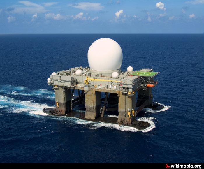
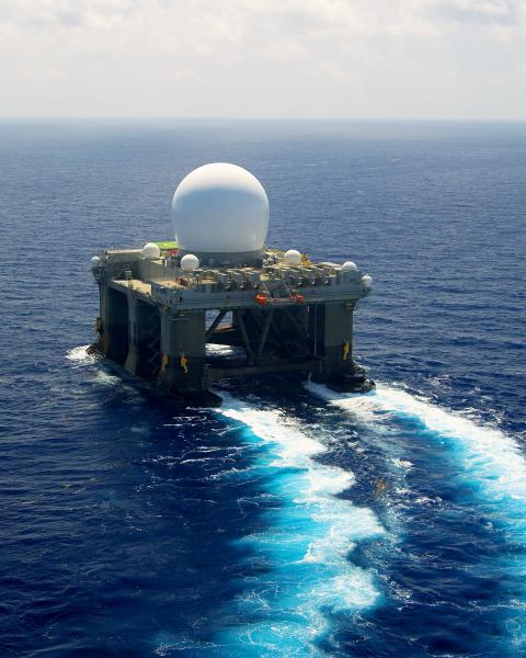
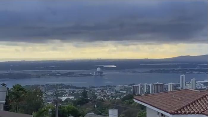
Originally built as a commercial semi-submersible heavy weather oil platform, this unit was acquired by the US Gov't and converted by Boeing into a self-propelled radar tracking station.
The 380ft long, 280 ft high, 50,000 ton platform was completed in between 2000-2005 and is designed to operate as part of the Ballistic Missile Defense System. The SBX uses Ultra High X-Band Radar to target multiple small targets, namely ICBMs, and relay the information to air, sea and ground units for interception and destruction. According to the Director of Missile Defence Agency, the SBX is reportedly able to track an object the size of a baseball over San Francisco from the Chesapeake Bay in Virginia, a distance of approximately 2900 miles.
Following a series of operational successes, issues and failures, the platform received a $27 Million upgrade to its targeting and sensor suite in the May of 2011 which pushed its active service date back to 2020, over a decade late. Once operational, the unit is slated to deploy out of Adak, Alaska where multi-million dollar mooring and support infrastructure has been constructed. The vessel is operated by the Military Sealift Command as part of the Special Mission Ships Program while the Missile Defense Agency retains responsibility for communications, the X-band Radar, and for mission integration.
www.msc.navy.mil/inventory/ships.asp?ship=213
Wikipedia article: http://en.wikipedia.org/wiki/Sea-based_X-band_Radar
Nearby cities:
Coordinates: 21°22'17"N 157°57'34"W
- Joint Base Pearl Harbor – Hickam (IATA: HIK – ICAO: PHIK) 1.1 km
- Pearl Harbor 3.9 km
- Fort Shafter 6.8 km
- Former Naval Air Station Barbers Point 14 km
- East Range Military Training Area 17 km
- Ewa Forest Reserve - Poamoho Section/Poamoho Training Area 19 km
- Naval Magazine Pearl Harbor (a.k.a. Naval Magazine Lualualei) 23 km
- Schofield Barracks Military Reservation 26 km
- Kawailoa Military Training Area 28 km
- Makua Military Reservation 35 km
- East Loch 1.1 km
- Middle Loch 2.5 km
- Hale Na Koa Village 3.2 km
- Officer Fields 3.8 km
- Joint Base Pearl Harbor – Hickam (IATA: HIK – ICAO: PHIK) 3.9 km
- West Loch 4.2 km
- Earhart Village 4.4 km
- Daniel K. Inouye International Airport (HNL/PHNL) 6.7 km
- Oʻahu 12 km
- Honolulu, Hawaii 16 km
Comments