Electrical substation (Gloucester)
United Kingdom /
England /
Gloucester /
A430 Castle Meads Way
World
/ United Kingdom
/ England
/ Gloucester
electrical sub-station
Add category
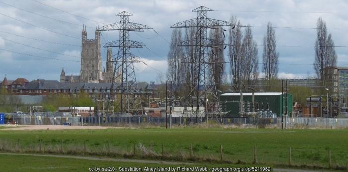
Castle Meads electrical substation on Alney was turned off when the island was flooded during Summer 2007 -Wikipedia
Photo: www.geograph.org.uk/photo/5219982
Photo: www.geograph.org.uk/photo/5219982
Wikipedia article: https://en.wikipedia.org/wiki/Alney_Island
Nearby cities:
Coordinates: 51°52'3"N 2°15'26"W
- Berkeley nuclear power station grounds 25 km
- Electricity substation 36 km
- Electrical substation 47 km
- Melksham Grid Sub Station 53 km
- Didcot switching yard 74 km
- Bramley Sub-Station 100 km
- Electrical substation 113 km
- Fleet 400kV Electricity Substation 117 km
- Elstree Sub-Station 134 km
- Lovedean Sub-Station 135 km
- Jack Morgan Farm 1.2 km
- Gloucester Railway Triangle 2.5 km
- Tredworth Road Cemetery 2.8 km
- Coney Hill Cemetery 3 km
- Gloucester Sewage Treatment Works 3.3 km
- Sir Thomas Rich's school grounds 3.6 km
- Walls Ice Cream Factory 3.7 km
- Robinswood Hill 4.1 km
- Imjin Barracks Military Housing Area 4.6 km
- Former RAF Innsworth / Imjin Barracks 5 km