All Hallows Staining (London)
United Kingdom /
England /
London /
Mark Lane
World
/ United Kingdom
/ England
/ London
tower
Add category
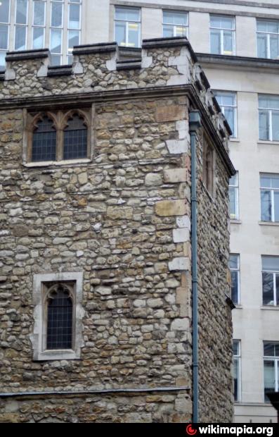
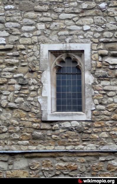
A 12th Century church rebuilt in 1674 after the Great Fire, which it mostly survived. INly the tower of the church now remains.
Wikipedia article: http://en.wikipedia.org/wiki/All_Hallows_Staining
Nearby cities:
Coordinates: 51°30'41"N -0°4'49"E
- The Tower of London 0.3 km
- Wote Street Tower (Festival Place) 75 km
- Debenhams Tower (Festival Place) 75 km
- Vue Tower (Festival Place) 75 km
- Churchill Way Tower (Festival Place) 75 km
- Brown's Folly Nature Reserve 154 km
- Irish National Heritage Park 452 km
- Inis Cealtra (Holy Island) 592 km
- Aghagower (Achadh Ghobhair) 681 km
- Killala (Cill Ala) 684 km
- Minster Court 0.1 km
- Tower Place 0.3 km
- Site of the Priory of Holy Trinity Aldgate 0.3 km
- Middlesex Street Estate Petticoat Square 0.5 km
- Walled Perimeter of Roman Londinium 0.6 km
- London Bridge 0.6 km
- Bank of England 0.6 km
- Regent’s canal 1.7 km
- Central London 2.8 km
- Tower Hamlets Council 3.2 km