Plagge Woods State Natural Area
USA /
Wisconsin /
Cornell /
World
/ USA
/ Wisconsin
/ Cornell
park
Add category
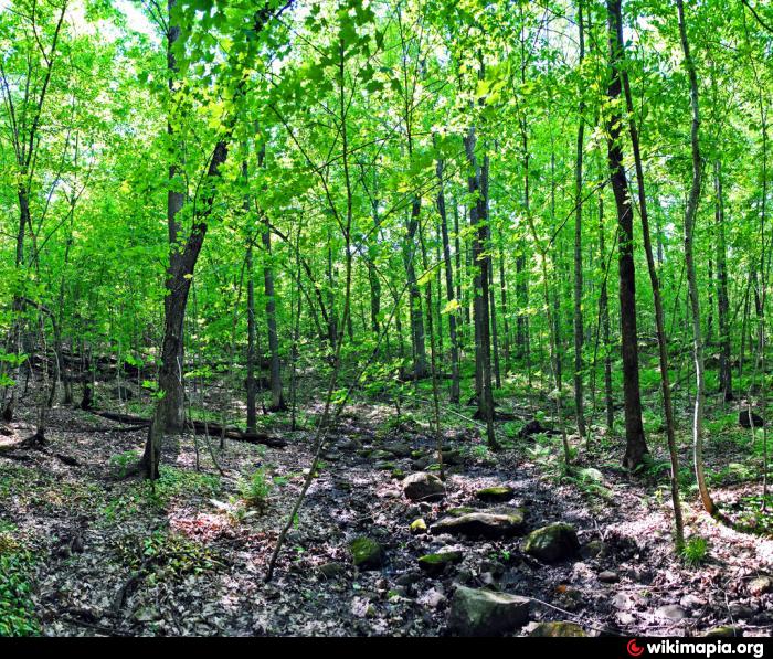
Plagge Woods is an old-growth northern mesic forest perched atop a monadnock, an isolated rock of conglomerate and quarzite rising 3-400 feet above the countryside. The forest is dominated by sugar maple, basswood, and red and white oak, which covers both the north and south slopes of a ridge on the southeastern edge of the Flambeau Ridge. The forest has a wide range of tree size classes, from seedling and sapling maples to the canopy layer of mature trees, some more than 30 inches in diameter at breast height (dbh). A few white pines on the north side of the tract are in the 3-foot dbh class. Groundlayer species are typical mesic woodland plants such as bedstraws, large-leaved aster, golden saxifrage (in springs), baneberries, miterworts, spring beauty, Canada mayflower, wild geranium, and violets. The site was donated by Henry and August Plagge. Plagge Woods is owned by the DNR and was designated a State Natural Area in 1975.
Nearby cities:
Coordinates: 45°16'34"N 91°11'56"W
- Chequamegon National Forest 77 km
- Interstate State Park 119 km
- Copper Falls State Park 133 km
- Wild River State Park 140 km
- St. Croix State Forest 143 km
- St. Croix State Park 149 km
- Brule River State Forest 149 km
- Nemadji State Forest 161 km
- General CC Andrews State Forest 177 km
- Jay Cooke State Park 182 km
- Holcombe Flowage/Lake Holcombe 4.5 km
- Long Lake 16 km
- Dunn Paper Inc. 23 km
- Timberline Trail Landfill Gas-to-Energy 23 km
- Ladysmith High School 24 km
- Flambeau School 25 km
- Riverside Cemetery 25 km
- Rusk County Airport 29 km
- Dairyland Reservoir 31 km
- Gilman High School 33 km