Bursa Thang
India /
Jammu and Kashmir /
Leh /
World
/ India
/ Jammu and Kashmir
/ Leh
World / India / Jammu and Kashmir / Ladakh (Leh)
mountain
Add category
BURSA thang on the right bank (east) of the Hanle River in SE Ladakh
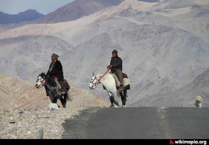
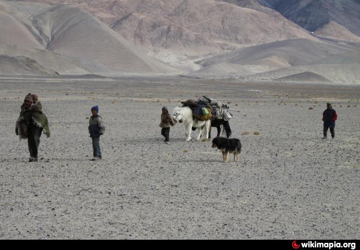
Stark and bare as it may seem, yet, there are moments when this plain and its adjacent plain Mankhang la teems with life especially in winter. Here are pictures of a migration of the Changpas in December 2010 from the NE edge of Bursa plain to near Tsomoriri.
Without their sheep dogs and horses these migrations from ribo (camp) to ribo would be impossible.
The photographs don't show it, but theree is always a wind in winter. In the evening and part of the night it is gale force whipping up sand and hurling it into the face of a fella unlucky to be outside. Nowadays they carry solar panels for light at night, and they have gas cylinders. That, bank accounts and jeans and jackets are the only concessions to modernity.
Nearby cities:
Coordinates: 32°58'15"N 78°55'25"E
- Volcanic cone 306 km
- Adamupaixis volcanic area 385 km
- Keliya (Keriya volcanic field) 420 km
- Volcano 453 km
- Kunlun Mountains 581 km
- Mazartag 681 km
- Bamaoqiongzong volcanic field 773 km
- Ulugh Muztagh Range (highest point 6,973 m/22,877 feet) 849 km
- Volcano 986 km
- Miran 1133 km
- Nilamkhul Plain 23 km
- Frozen Indus 27 km
- Kalaktartar Plains 37 km
- Ukdungle 42 km
- Changthang Wildlife Sanctuary 62 km
- Chinese occupied demchok 63 km
- Tsosip Sumkyil (Chulusongjie) 91 km
- Frozen Lake 92 km
- Chango Glacier 117 km
- Shiquanhe Reservoir 130 km