Bottleneck
India /
Jammu and Kashmir /
Kargil /
World
/ India
/ Jammu and Kashmir
/ Kargil
World / Pakistan / Northern Areas / Northern Areas
mountain climbing, couloir

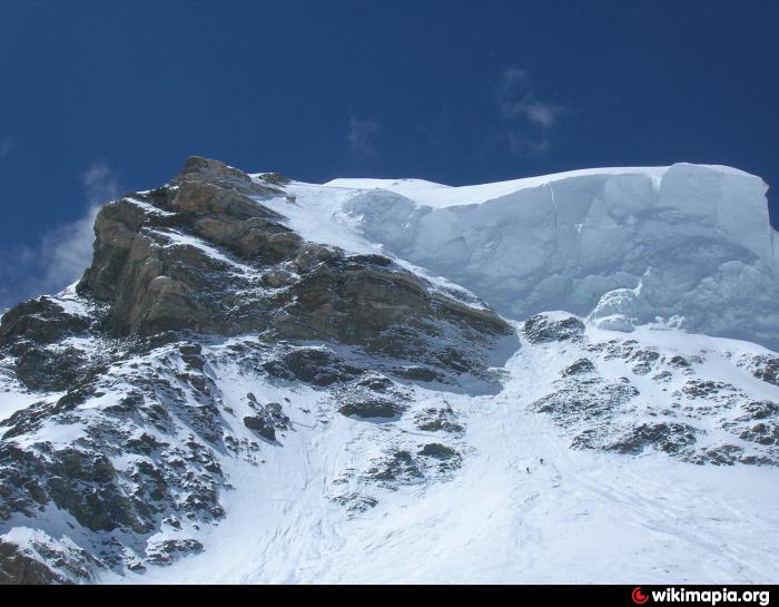
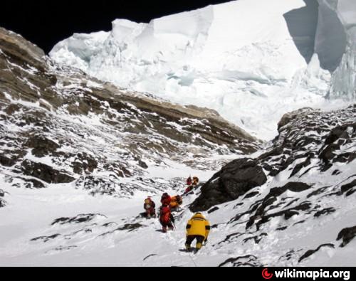
The Bottleneck is a narrow couloir, which is overhung by seracs from the ice field east of the summit. The couloir is located only 400m below the summit, and climbers have to traverse about 100m exposed to the seracs to pass it. Due to the height (8200m) and the steepness (50-60 degrees) this stretch is the most dangerous part of the route.
Wikipedia article: http://en.wikipedia.org/wiki/Bottleneck_(K2)
Nearby cities:
Coordinates: 35°52'47"N 76°31'7"E
- Japanese Couloir 23 km
- Norton Couloir 1316 km
- Сouloir "The dream of snowboarder" 3009 km
- Сouloir "The rattle" 3009 km
- Сouloir "The tear of Komsomol's gearl" 3010 km
- Сouloir "The big avalanche cone" 3010 km
- Сouloir "The Mini-Grande" 3011 km
- Сouloir "The Grande" 3011 km
- Cold couloir 3671 km
- Couloir Davin, massif des Écrins 5838 km
- K2 north side Glacier 10 km
- North Gasherbrum Glacier 16 km
- Gasherbrum massif 20 km
- Baltoro Glacier 22 km
- Sarpo Laggo Glacier 24 km
- Shaksgam Valley 25 km
- Gondukoro/Gondogoro Glacier 33 km
- Masherbrum Range 33 km
- Aling glacier (with tributaries) 46 km
- Choktoi Glacier 58 km