Where the Palm Meets the Pine
USA /
California /
Parkwood /
World
/ USA
/ California
/ Parkwood
World / United States / California
landmark, trees, boundary marker
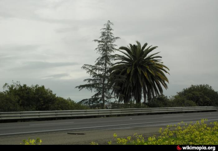
Legend has it that this marks the divide between Southern California (the palm tree) and Northern California (the evergreen). While no one has been able to verify the origin of the trees, a public outcry went up in the late 1980s, when the trees were nearly bulldozed to make room for Highway 99. Cal-Trans relented, and the trees remain a symbolic reminder of Madera’s place near the exact center of the state.
Nearby cities:
Coordinates: 36°54'15"N 120°0'2"W
- Mariposa Grove 77 km
- Giant Forest 116 km
- Bryan Ave eucalyptus tree windrow 408 km
- Logging clear cuts 414 km
- Kamiak Butte 1134 km
- McNutt's Island 4620 km
- Trout Brook Wilderness Area 4899 km
- Qinngua Valley 5742 km
- Boltby Forest 8319 km
- Holmwood Common 8603 km
- Parksdale, California 5.3 km
- Madera-Bonadelle Ranchos 12 km
- Madera Airport (MAE/KMAE) 14 km
- Madera Acres, California 14 km
- Madera Lakes 16 km
- Wastewater Treatment 16 km
- Valley Lake Ranchos 18 km
- Central California Women's Facility 25 km
- Valley State Prison 26 km
- Hensley Lake 27 km