PIA Plane Crash Area
Nepal /
Kathmandu /
Kirtipur /
World
/ Nepal
/ Kathmandu
/ Kirtipur
World / Nepal / Central / Bagmati / Lalitpur
place with historical importance, historical layer / disappeared object


This is (Nepal) Lalitpur district, BhDate: September 28, 1992
Time: 2:30 PM
Type: Airbus A300B4-203
Registration: AP-BCP
C/n: 025
Year built: 1976
Crew: 12 fatalities/12 on board
Passengers: 155 fatalities/155 on board
Total: 167 fatalities/167 on board
Location: Kathmandu; 20 km S (Nepal)
Phase: Initial approach
Nature: Scheduled passenger
Flight: Karachi - Kathmandu
Flight number: PK-268
Remarks: PIA flight PK-268 departed Karachi at 11.13 AM for a flight to Kathmandu. The en route portion of the flight was uneventful and the aircraft was cleared for a Sierra approach to Kathmandu Runway 02. The crew was instructed to maintain 11500ft and report at 16DME (16mls from the VOR/DME beacon, which is located 0,6nm short of the runway). The Kathmandu approach is very difficult, since the airport is located in an oval-shaped valley surrounded by mountains as high as 9,665ft. Runway elevation is 4313 above mean seal level (AMSL). The next approach fixes for PIA flight 268 were at 13 DME (at 10500ft), 10 DME (at 9500ft) and 8 DME (at 8200ft). A few seconds after reporting 10 DME, the aircraft was descending through 8200ft (the altitude for 8 DME!). The Airbus crashed into a steep cloud-covered hillside at approx. 7300ft AMSL, at 9,16 DME.
Source: ASW 5.10.1992 (3/4) + 6.2.1995 (5); AW&ST 5.10.1992(36); FI 4-10.11.1992 (8) + 31.3-6.4.1993 (4); Asia Pacific Air Safety Dec.1992 (10-12) + ICAO Adrep Summary 2/94 (#1)
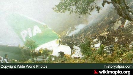
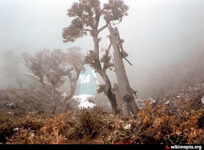
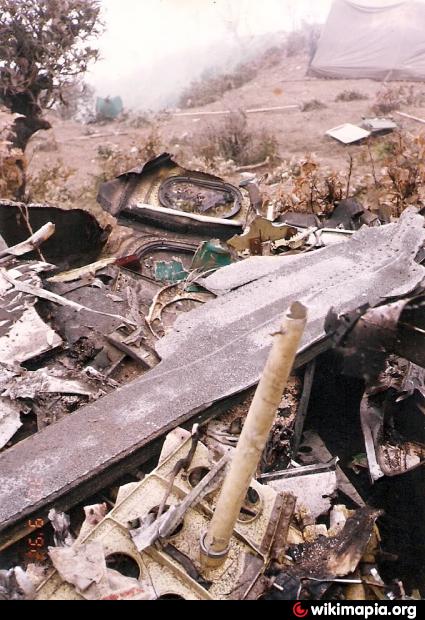
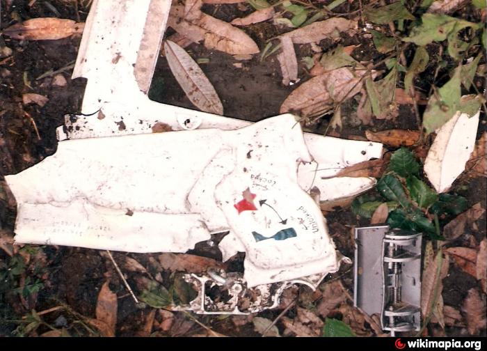
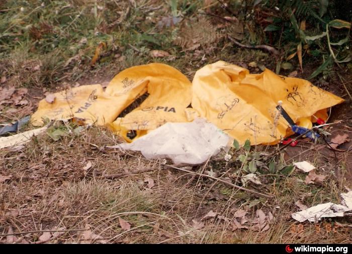
PIA Airbus A300B4-203, AP-BCP, after crashing into 'Fan Marker Hill' 9nm south of Kathmandu Airport, Nepal, on September 28, 1992. Resting amid the native rhododendrons, its smoking embers mixing with the misty cloud base, the empennage of AP-BCP tells its own tragic story. The sharp gashes in the leading edges of fin and starboard stabilizer attest to the violence of the disintegrating aircraft's passage through the dense canopy of the hillside jungleattedada VDC where was crashed PIA plane.
Source: www.historyofpia.com/accidents4.htm,
www.historyofpia.com/forums/viewtopic.php?t=13303
_ By Govinda Prasad Neupane
Time: 2:30 PM
Type: Airbus A300B4-203
Registration: AP-BCP
C/n: 025
Year built: 1976
Crew: 12 fatalities/12 on board
Passengers: 155 fatalities/155 on board
Total: 167 fatalities/167 on board
Location: Kathmandu; 20 km S (Nepal)
Phase: Initial approach
Nature: Scheduled passenger
Flight: Karachi - Kathmandu
Flight number: PK-268
Remarks: PIA flight PK-268 departed Karachi at 11.13 AM for a flight to Kathmandu. The en route portion of the flight was uneventful and the aircraft was cleared for a Sierra approach to Kathmandu Runway 02. The crew was instructed to maintain 11500ft and report at 16DME (16mls from the VOR/DME beacon, which is located 0,6nm short of the runway). The Kathmandu approach is very difficult, since the airport is located in an oval-shaped valley surrounded by mountains as high as 9,665ft. Runway elevation is 4313 above mean seal level (AMSL). The next approach fixes for PIA flight 268 were at 13 DME (at 10500ft), 10 DME (at 9500ft) and 8 DME (at 8200ft). A few seconds after reporting 10 DME, the aircraft was descending through 8200ft (the altitude for 8 DME!). The Airbus crashed into a steep cloud-covered hillside at approx. 7300ft AMSL, at 9,16 DME.
Source: ASW 5.10.1992 (3/4) + 6.2.1995 (5); AW&ST 5.10.1992(36); FI 4-10.11.1992 (8) + 31.3-6.4.1993 (4); Asia Pacific Air Safety Dec.1992 (10-12) + ICAO Adrep Summary 2/94 (#1)
PIA Airbus A300B4-203, AP-BCP, after crashing into 'Fan Marker Hill' 9nm south of Kathmandu Airport, Nepal, on September 28, 1992. Resting amid the native rhododendrons, its smoking embers mixing with the misty cloud base, the empennage of AP-BCP tells its own tragic story. The sharp gashes in the leading edges of fin and starboard stabilizer attest to the violence of the disintegrating aircraft's passage through the dense canopy of the hillside jungleattedada VDC where was crashed PIA plane.
Source: www.historyofpia.com/accidents4.htm,
www.historyofpia.com/forums/viewtopic.php?t=13303
_ By Govinda Prasad Neupane
Nearby cities:
Coordinates: 27°32'8"N 85°17'15"E
- Godavari 11 km
- Kathmandu Nepal 18 km
- Bhaktapur 20 km
- epicenter of M4.4 quak on 20.5.15 36 km
- epicenter of M308 quake on 26.5.15 36 km
- 2015 Nepal Earthquake(7.8) Epicenter 94 km
- Khangchendzonga National Park 276 km
- Kokaley Busty East Sikkim 315 km
- Gangtok 328 km
- 50 Turnings on old silk road 344 km
- sallaghari area 3.9 km
- Pharping - 1 Kathmandu 5.6 km
- mandu hydro 6.4 km
- Bungmati - 3, Lalitpur 6.4 km
- Chhaimale VDC 6.5 km
- Bungmati 2, Lalitpur 6.7 km
- Tahakhel,Chapagaun, Lalitpur 7 km
- KOPU GAUN-6 7.3 km
- Chapagaon VDC 7.9 km
- Bajrabarahi Jungle (Forest) 8.9 km