Junction (Kohima)
India /
Nagaland /
Kohima
World
/ India
/ Nagaland
/ Kohima
World / India / Nagaland / Kohima
road junction
Add category
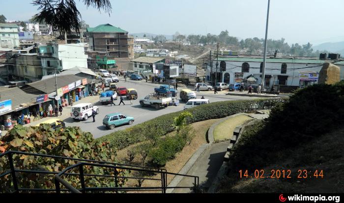
At the east side of this road junction is the Word War II cemetery. The National Highway 39 (south-west from Imphal) skirts the cemetery and takes a U-turn to Dimapur. Another road from this junction goes to Head Post Office and beyond to Mokokchung.
Nearby cities:
Coordinates: 25°40'5"N 94°6'17"E
- Manja Tiniali 75 km
- Valley of Manipur 89 km
- Manipur 110 km
- Hanhsora Chariali 136 km
- Jnazi Point 138 km
- Ghahi Gaon 144 km
- Kaliabor Tiniali 153 km
- Kaliabar 156 km
- Kashipur Junction 157 km
- Kalia Bhomora bridge (length-3015 mtrs) 163 km
- 16 Assam Rifles 0.8 km
- KEZIEKE 1.1 km
- T.khel 1.3 km
- A.G colony 1.4 km
- D. Khel 1.5 km
- Electrical Colony 1.6 km
- L.khel 1.6 km
- sector 39 2.4 km
- Pfüchama Village (By Asao) 3.7 km
- Manipur 97 km