Zoning transition (East Palo Alto, California)
USA /
California /
Menlo Park /
East Palo Alto, California
World
/ USA
/ California
/ Menlo Park
World / United States / California
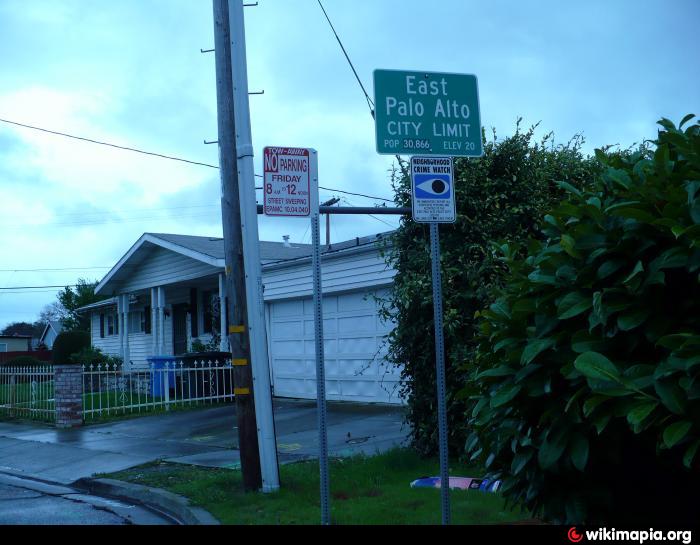
Any pedestrian or person in a vehicle will notice a sharp transition in these few tens of feet between the commercially zoned area to the west and the residential zoned area to the east. This sharp transition is, in part, due to the fact that this is a municipal boundary between the cities of Menlo Park and the less-wealthy East Palo Alto.
Nearby cities:
Coordinates: 37°28'30"N 122°8'46"W
- Inner Bair Island 9 km
- Eagle Hill 9 km
- Middle Bair Island 11 km
- Island J 12 km
- Runnymede Sculpture Farm 12 km
- Bay Cities Auto Auction 17 km
- spam 19 km
- De Guigné estate 20 km
- Five Canyons (Castro Valley) 26 km
- Waste Management-Davis Street Transfer Station 27 km
- Kavanaugh neighborhood 0.3 km
- Palo Alto Park 0.7 km
- Belle Haven 1.3 km
- VA Hospital 1.6 km
- Menlo Oaks, California 2.1 km
- Saint Patrick's University & Seminary 2.6 km
- Lindenwood 3 km
- Hetch Hetchy Pipeline 4.6 km
- Don Edwards San Francisco Bay National Wildlife Refuge 6.7 km
- San Francisco Bay 29 km