Edge of the world
Saudi Arabia /
Riad /
Hhuraymila /
World
/ Saudi Arabia
/ Riad
/ Hhuraymila
, 20 km from center (حريملاء)
World / Saudi Arabia
mountain, rocks

Edge of the World
The thick green line of trees along Acacia Valley have made this a very popular picnic spot, especially after rain, when you will find the wadi full of flowers and flowering shrubs, butterflies, lizards, dragonflies, and birds.
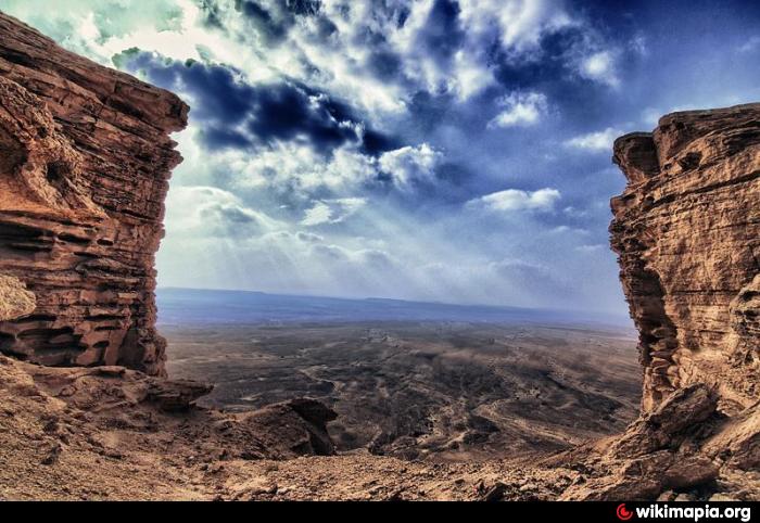
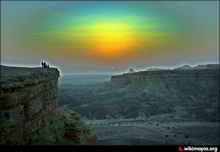
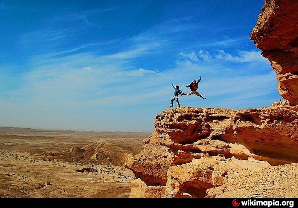
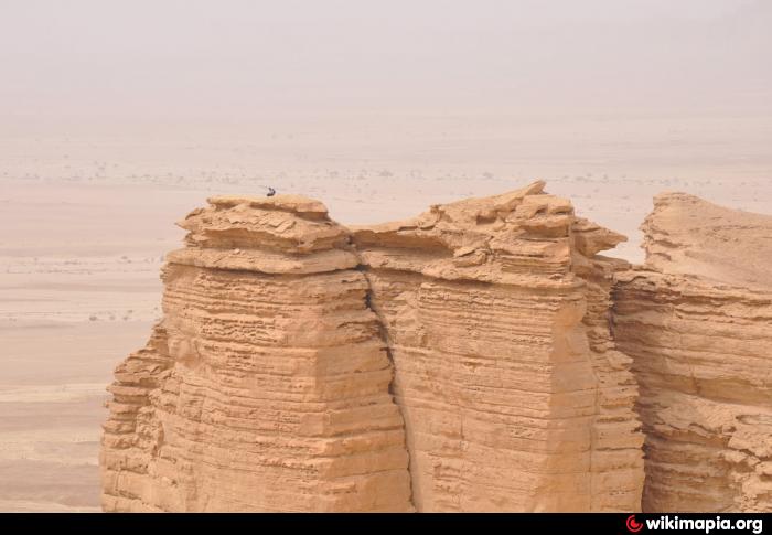
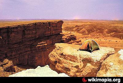
The Edge of the World is a rock-framed "window" with a wonderful view of the valley below. It is about 180 km North-East of Riyadh. Edge of the World is located up straight from the Acacia Valley. This place is also called the rock framed window because from the cliffs you can see a dramatic view of the plains below.
Directions:
At Kingdom Tower, Olaya, Riyadh, set your odometer at Zero. Take the Uruba Road (west) and watch for the signboard 'King Khalid Eye Hospital' (KKEH). At 3.7 km you will get an exit to Madinah/Qassim at the KKEH. Follow this road which after 10 km leads to Salbouk. At 34.5 km you will get an exit to Sadous/Jubayla. Take this exit and head to Sadous. You will pass by Jubayla, Uyainah and Hegra. At 66.5 km (which is 24.5 km from Jubayla) turn left to an off-road. After entering this path, on your left side is iron fence, and you may follow the track (towards west, turning slightly to your right) until you reach a fenced area with a gate at 7.5 km from the main road. Enter the gate, turn right and follow any convenient track for 22 km.
www.arriyadh.com/Eng/Tourism/Content/Tab1/Camping/getdo...
.
The thick green line of trees along Acacia Valley have made this a very popular picnic spot, especially after rain, when you will find the wadi full of flowers and flowering shrubs, butterflies, lizards, dragonflies, and birds.
The Edge of the World is a rock-framed "window" with a wonderful view of the valley below. It is about 180 km North-East of Riyadh. Edge of the World is located up straight from the Acacia Valley. This place is also called the rock framed window because from the cliffs you can see a dramatic view of the plains below.
Directions:
At Kingdom Tower, Olaya, Riyadh, set your odometer at Zero. Take the Uruba Road (west) and watch for the signboard 'King Khalid Eye Hospital' (KKEH). At 3.7 km you will get an exit to Madinah/Qassim at the KKEH. Follow this road which after 10 km leads to Salbouk. At 34.5 km you will get an exit to Sadous/Jubayla. Take this exit and head to Sadous. You will pass by Jubayla, Uyainah and Hegra. At 66.5 km (which is 24.5 km from Jubayla) turn left to an off-road. After entering this path, on your left side is iron fence, and you may follow the track (towards west, turning slightly to your right) until you reach a fenced area with a gate at 7.5 km from the main road. Enter the gate, turn right and follow any convenient track for 22 km.
www.arriyadh.com/Eng/Tourism/Content/Tab1/Camping/getdo...
.
Nearby cities:
Coordinates: 24°57'43"N 45°59'8"E
- Dahrat Laban 58 km
- مـــــفيــــــض وادي الخنــــــــــــقـــــــة 122 km
- Bela'om mountain 141 km
- Red Mountain Jwoodh 297 km
- Jabal Al hamra 372 km
- Alzubna Hill 422 km
- Al Mamtala 466 km
- Al Romaitha 470 km
- Al Jaseera 473 km
- Jaw 479 km
- Al-Barrah Mosque 14 km
- البرة الجديدة 14 km
- مزرعه 14 km
- مزرعة العبيدية ـ أم القراف سابقا 18 km
- الزهيريه 19 km
- Mosque 23 km
- الدبيجه :ديره طحاطيح نجد 23 km
- بلدة أم سليم 27 km
- طريق و وادي عبيثران في محافظه ثادق 29 km
- طريق ثادق - الرويضه - رغبه 32 km
Comments